What an exciting place to learn about history from a cultural, industrial, environmental and anthropological point of view.
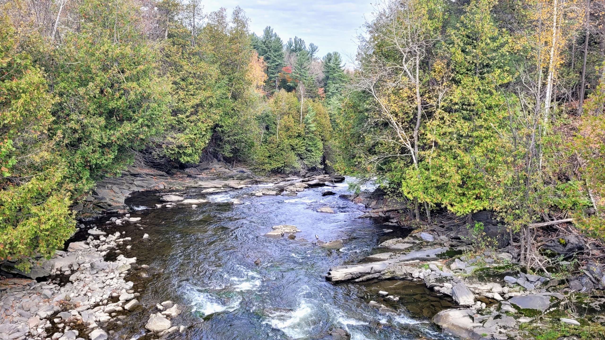
In September, the Massawippi Conservation Trust signed a deed of servitude with the municipality of Stanstead East in order to protect the land immediately adjacent to the falls. This land and the Niger river that flows through it, have been central to our local history for thousands of years. They are in the Appalachian geological corridor of Quebec.
This is the traditional territory of the Abenaki people. Thanks to recent archaeological digs, we have concrete evidence of their passage and presence along the Niger River. Abenaki archaeologists have studied the land above the falls all the way back to Lake Lyster from where it flows. The flat plains were good for hunting and fishing, a dry place for the semi-nomadic people to move through season after season. The river was the passageway to travel from the south to Lake Massawippi, another rich hunting and fishing ground.
“We had a cursory archaeological dig done to see what was on the Abenaki territory. We found a striker that dates back thousands of years. We also found quartz from Mount Pinnacle,” recounted Pamela B. Steen, municipal councilor (now Mayor) in La Tribune April 2021 article. Quartz was a type of mineral that was used for barter.
Zoom forward past the arrival of the French and English fur traders to the period of colonial settlement. Other people started arriving in the region in the latter half of the 1700s. Some were Europeans, others had official land grants and many arrived on foot, from the northeastern United States, people who were in search of land. Like those before them, the settlers recognised the river as a rich source of food, transportation and power. We do not know much about the Tatton family, a black family that came here in 1804. But it seems that the river, originally called the Negro River, derived its name from them. The river`s name changed over time from Negro to Nigger and finally to the Niger River. The current name “Niger River” is first reported in 1863 on the Map of the “District of St Francis (Putnam and Gray)”. The word “niger” comes from the Latin form of “black”. The toponym “rivière Niger” was made official on September 14, 2006, at the Commission de toponymie du Québec.
One man, Stephen Burroughs, famous for his ability to adapt to the times, became the namesake of the falls. His infamy comes from his skills as a counterfeiter. He was born in New Hampshire in 1765 and according to his own memoires was `the worst boy in town`. He was a swindler and prankster. During the American revolution he impersonated a doctor when he shipped out on a Yankee privateer. Later he stole his father`s sermons (his father was a Presbyterian minister) in Massachusetts and he impersonated a preacher performing marriages, baptisms and more. Finally, he saw a potential in counterfeiting coins and paper money. He eventually ended up in Stanstead Township in 1799 with his wife Sally and their children. Like others, he cleared land and built saw and grist mills. He was possibly the first to build a mill on the river. He was well regarded by his neighbours. The colourful story of his life is well documented in American and Canadian articles (see bibliography below).
 Throughout the 19th and early 20th centuries, the site passed through several hands as agriculture and forestry formed the basis of the economy in northern Stanstead Township. In 1854, a sawmill, a blacksmith shop, a bridge and farm buildings were located near the site. Just above the falls, a house was built between 1883 and 1906, accompanied by a barn-stable. Evidence of these human activities have been corroborated by archaeologists.
Another important part of the history of Burrough`s Falls is it`s hydro power. The Niger River had many mills along its banks and in 1929 a hydro station was built by Southern Canada Power Ltd (SCP). There was a 2,000 HorsePower mill operating in 1930 according to the SCP annual report.
The construction of this small power station was of strategic importance to Southern Canada Power Company, which wanted to be closer to the industrial development of Rock Island, which was more than 100 km from the Chute-Hemming power station. What’s more, the new power station would also make it possible to secure the southern grid in the event of a power distribution problem.
With the nationalization of Quebec’s hydroelectric network in 1963, the power station became the property of Hydro-Québec. In the 1980s, several installations were dismantled, including the barn.
In 2010, a major break occurred in the penstock, resulting in the permanent shutdown of electricity production. Between 2014 and 2016, the balance stack and penstock were dismantled.
In 2021 the municipality of Stanstead East acquired the site from Hydro Quebec for future recreational purposes and to protect it from further transformations. It had the hydro station recognised and registered as a heritage building.
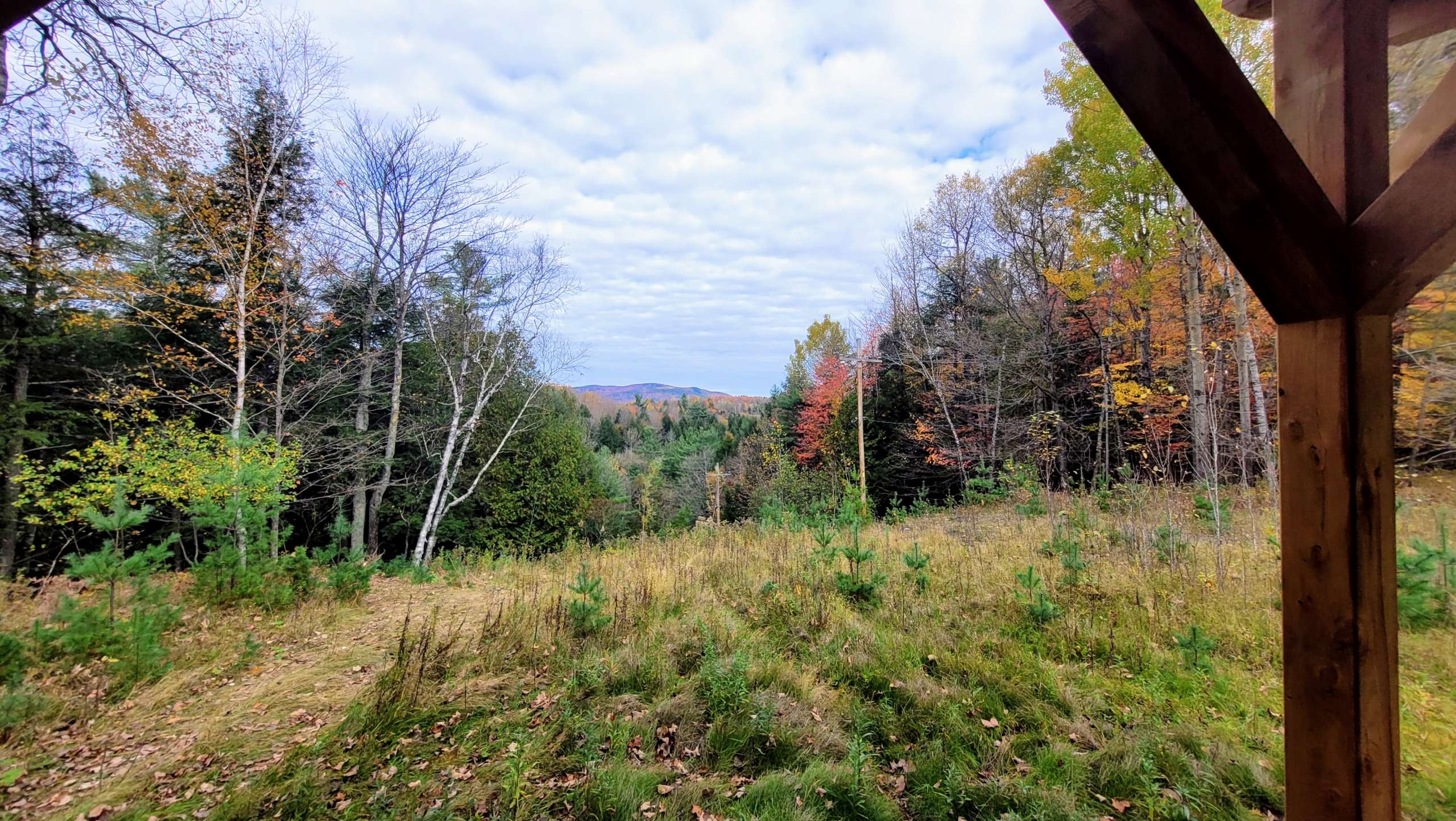
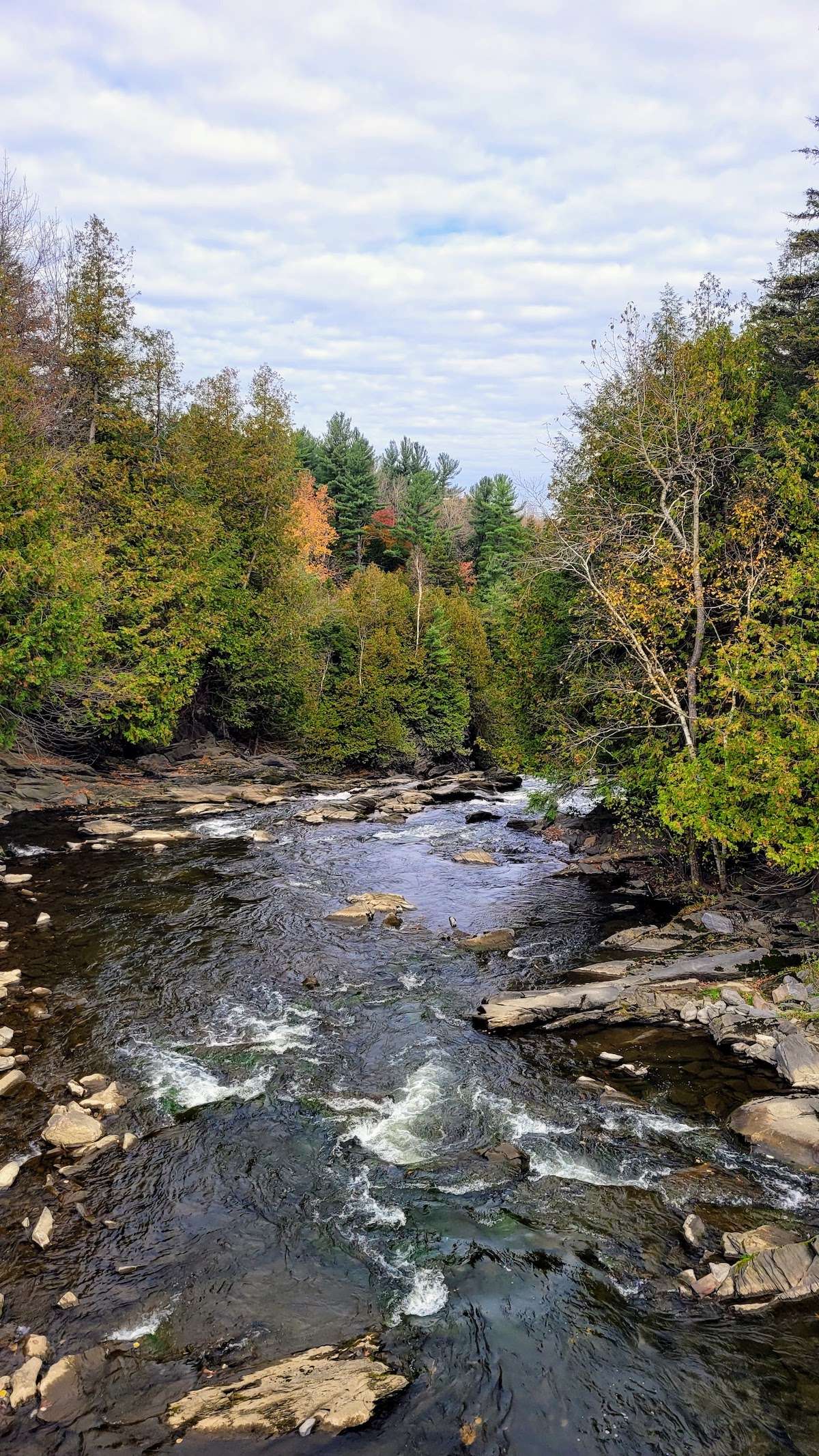 The heritage site is also of interest for its landscape value. The site is marked by the presence of the 55.17 m-high Burroughs Falls, part of the Niger River. The property, which is largely wooded, also features several types of forest stands: cedar, hemlock, maple, and tall pines planted along the access road.
The newly renamed property, Parc des Chutes-Burroughs, is home to several types of habitat: forest environments; aquatic habitats comprising the Rivière Niger, its waterfalls and certain streams; and treed swamps, some of which are located in flood-prone areas. Some streams are home to a species of salamander likely to be designated threatened or vulnerable in Quebec, the Northern Dusky Salamander.
As for the plant species present, Canada fleabane, two-leaved toothwort and ostrich fern matteuccia are species vulnerable to harvesting, while Provancher’s fleabane is a threatened species in Quebec.
In September 2023 the Massawippi Conservation Trust signed a conservation servitude to protect the 36 acre property in perpetuity. Part of the site will continue to thrive as a park and recreational area. The municipality intends to open the space to visitors with an exhibit at the hydro station and allow walkers to enjoy the forests and river`s edge in late 2024 or early 2025.
Bibliography
https://www.patrimoine-culturel.gouv.qc.ca/detail.do?methode=consulter&id=233557&type=bien
https://cantondehatley.ca/en/information/about-hatley-township/