by Matthew Cleary (Updated September 13, 2024)
The Massawippi Trail just got a lot longer. A new sector of protected land, forest and wetlands with over 5 kilometers of new hiking trails, is now open to the public. The trail that once ended at Ethan’s Beach now continues on further south. You can, of course, continue to walk down to the beach, have a picnic or jump in the lake, and hike back out the way you came. If it ain’t broke… etc. If you have the time and energy to continue, though, there is now more to see and farther to go
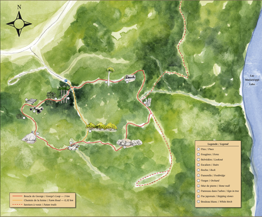
Avid readers of this newsletter might remember an essay in a previous edition that reminisced about the conceptualization and construction of George’s Loop in 2017. The trail map at the time can be found below. Once it opened, we were so excited and touched to see hikers using the trail. If there were cars we didn’t recognize in the parking lot, strangers discovering and taking advantage of this thing that we made, we got so excited. We had had the place to ourselves for so long. We were proud hosts when guests arrived. George’s Loop has evolved and aged as plants and animals have reclaimed the landscape since 2017. It has been maintained and repaired as weather and use have left their marks. It remains a beautiful trail. We did not stop building hiking trails, though. We set off toward the lake.
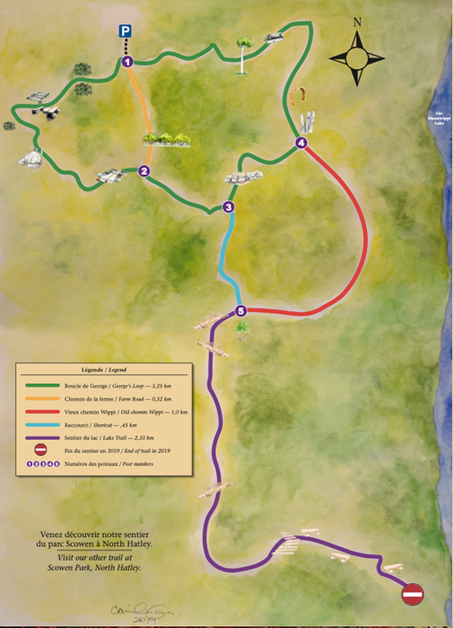
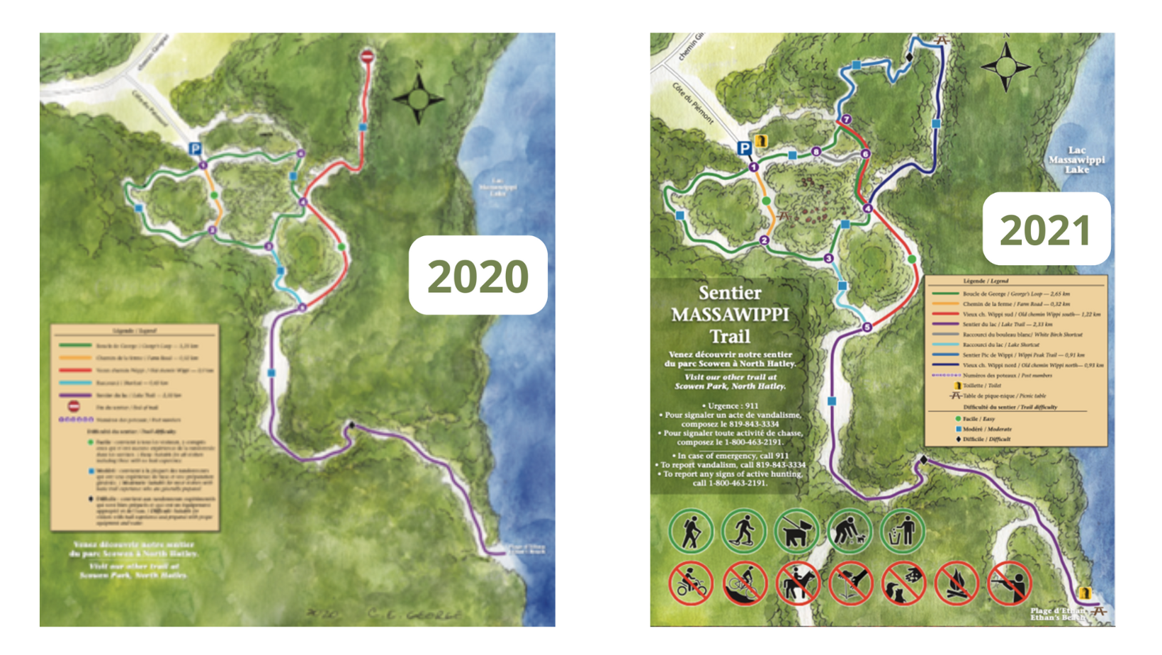
In 2019, the Lake Trail opened. The number of kilometers of trail more than doubled. Hikers hoping to arrive at Lake Massawippi at the end of their descent, though, would have been disappointed. You could get close. You could walk more than 3 kilometers down toward the lake, but at the time, the lake itself was not accessible. There was still too much infrastructure to build at the place soon to be named Ethan’s Beach. (See map below.)
The following year in 2020, Ethan’s Beach opened, complete with benches and picnic tables, the most beautiful outhouse in the world, and a grand staircase to descend the last steep slope to reach the water (see map below).
Outside of the woods, the pandemic began, and more and more people sought refuge in the great outdoors to find peace and space, exercise or community. The Massawippi Trail appeared on Google Maps. Our parking lot filled up. Hikers were everywhere. I still recognized a few, but there were so many others that I did not. The Massawippi Trail became more and more of an institution and a local favorite. We needed more hiking trails.
The Wippi Peak Trail opened a year later in 2021, closing the last loop to be made in the Wardman Sector. The resulting map, probably the map with which you are all most familiar (see below), had remained unchanged until just a few weeks ago. We did not stop building hiking trails.
Enter 2024
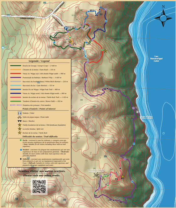 After three years of hard work by the trail-building team, and all the planning and fundraising that the Boards of the Massawipppi Foundation and Massawippi Conservation Trust have accomplished over the past several years, the cooperation of various stakeholders, as well as the countless contributions of friends, supporters, and benefactors, we (the trail-building team) are very excited to finally open the trails on which we’ve been working, to play proud hosts again.
As indicated on the map, the newly opened trails are all to the south of Ethan’s Beach. The parking lot remains to the north. Hiking on the newly open section of trails requires that hikers first walk almost all the way to Ethan’s Beach. Rather than beginning the final descent down to Lake Massawippi, about 200 meters from Ethan’s Beach, hikers can now continue farther south on Barbara’s Way. The trail continues on a forestry road for a bit before climbing back up into the forest.
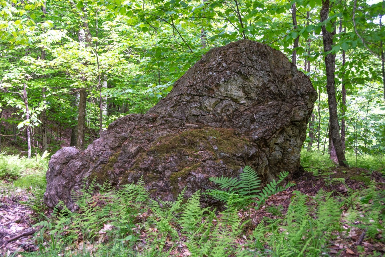
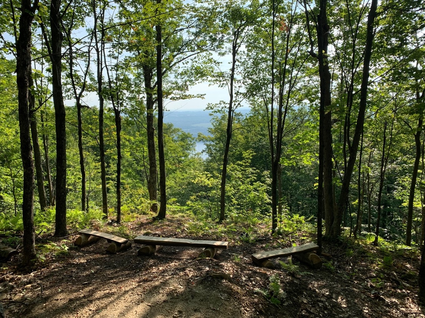
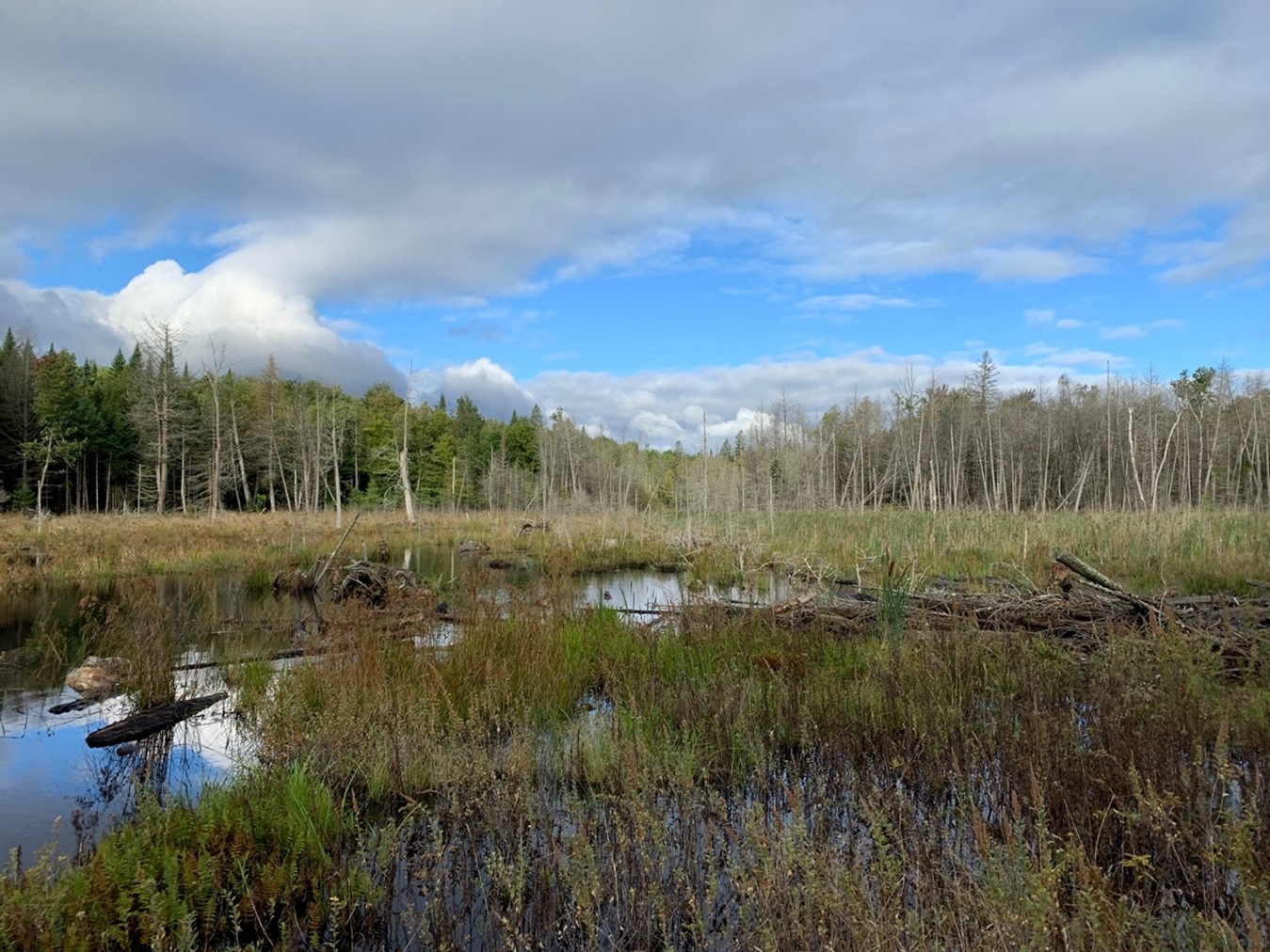 The new trails, an out-and-back portion of trail leading to a loop, offer an opportunity to explore some of the most beautiful, remote and diverse ecosystems found on property conserved by the Massawippi Conservation Trust. There are yellow-spotted salamanders and broadwing hawks, rustic bridges built over mountain streams, and what looks like a turtle on topographical maps with a boulder for a head. There is a marsh created by beavers, Norman’s Marsh, that is now home to all sorts of animals. It is one of the most peaceful places you will ever find. There is a view of Lake Massawippi from which you can almost see North Hatley and Ayer’s Cliff at the same time once all the leaves have fallen.
Keep in mind, it is far and hilly. You have to earn it. It will certainly take several hours to get to the new section and explore it completely, and once you have, you still must walk back up the hill from the lake to get back to the parking lot. Bring food and water. Check the weather. It is worth the hike, though. It is a beautiful trail. We are proud hosts.
