Reflections on Some Common Nature “Do’s and Dont’s”

Part 2: Signs of Human Presence

Written by Jessica Adams (Nature Nerding)
Reading time: 5-6 minutes
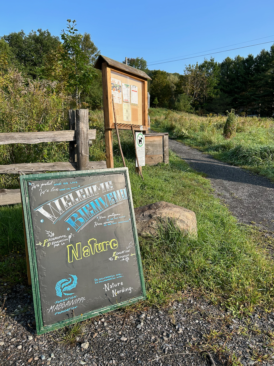
The new program for the grade 4 students visiting our trails revolvings around Noticing Signs of Animal Presence. Throughout February and March we had so much fun scouring Scowen Park for clues, investigating and discussing who might have left each clue behind. We were lucky enough to come across tracks, scat, signs of browsing and even some bones, fur and bits of skin left over from a White-Tailed Deer. Each outing served as a reminder that if we pay close enough attention, we can see signs of animals going about their activities all around us, even in the dead of winter.


What happens when animals of the Homo sapiens variety go about their activities in the forest? What types of clues do they leave behind?

In this article we will dive into the “Signs of Human Presence”, considering some of the usual signs left behind by the humans passing through natural areas and some of the not-so-usual signs that have a greater impact than we might realize. This is the second in a series of articles meant to encourage deeper reflection on the principles underlying the guidelines common to so many trail networks (see Part 1 on Respecting the Trail from the March-April newsletter). With the number of people enjoying natural spaces increasing, it is more important than ever to view park guidelines as invitations to participate in reducing our collective impact and hence preserving the natural areas we cherish.


Part 2: Signs of Human Presence


For the Love of Parks


In 2021, Parks Canada and Ontario Parks joined forces in promoting the For the Love of Parks campaign – one meant to “inspire visitors to enjoy (…) amazing places responsibly, for the enjoyment of everyone.” (Parks Canada)


Why do we visit natural areas? Presumably it is because there is something about them that draws us in, that is special and that we love. Why, then, would we make choices that slowly degrade these areas over time?


Oftentimes human actions (unwitting or not) pose a real threat to the ecological integrity of the spaces we frequent. “Ecosystems have integrity when they have their native components intact.” (Parks Canada) Organisations managing natural areas have a responsibility to keep this in mind when it comes to providing access to said areas. The mandate to make these areas accessible should never take precedence over the mandate to protect them. It is therefore everyone’s responsibility to uphold the integrity of these spaces – for the sake of preserving ecosystems and for the sake of preserving our right to access them.


Undesirable Number 1: Good Old Trash
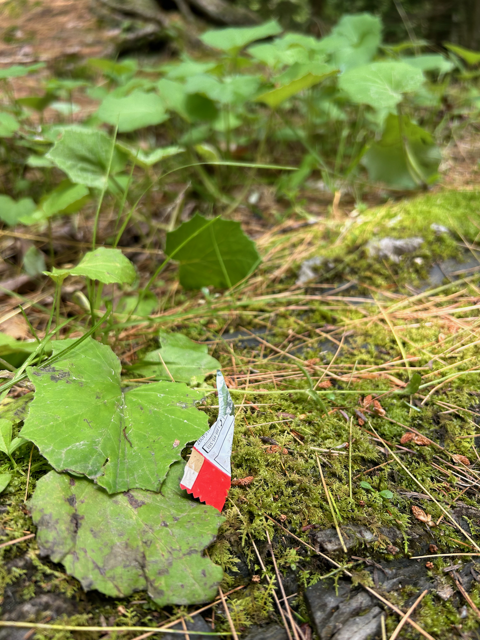
 

It is heartbreaking and frustrating when we stumble across trash in the middle of a natural area. When we see this somewhere that is special to us… it almost feels personal. In addition to it being offensive and unsightly to other park visitors, it is problematic for wildlife because it doesn’t belong.


Everything in an ecosystem serves a purpose and is able to participate in a relatively balanced energetic exchange with the other components. Whether it be to provide substrate, nutrients or shelter, the role is necessary and the impact is moderated by the other processes going on simultaneously.


Trash is foreign and not only unable to contribute positively to an ecosystem, but can create an important imbalance. Firstly, trash takes a long time to degrade and while doing so, leaches toxins (and zero nutrients) into the soil. Second, various types of waste have the potential to cause needless suffering and even mortality. From empty bags to plastic containers, curious wildlife picking up the scent of food can become trapped and suffocate or starve to death. Other items can easily be mistaken for food and can be ingested, causing choking or other digestive issues that can lead to death. Moreover, whether mistaken for food or not, anything with a sharp edge to it can cause injury to unsuspecting critters, leaving them vulnerable.


Various forms of trash have the potential to take a lot from an ecosystem without giving a single thing in return… but what about the things that can eventually break down? Are they as bad?


The Not-So-Usual Suspects
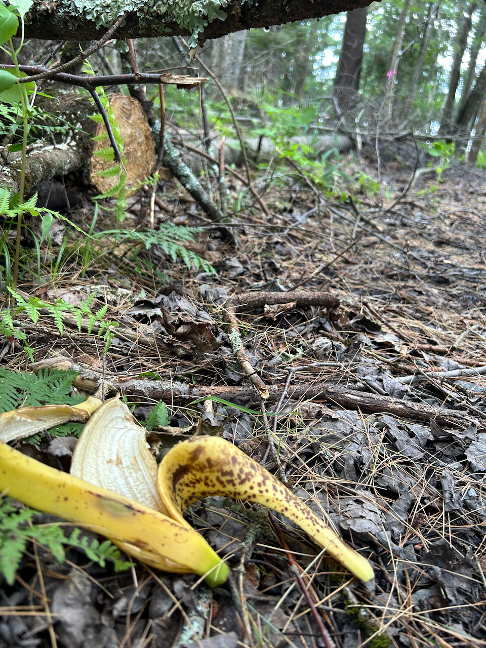
“But… it’s biodegradable!” I hear this often during our fall post-outing snack when I ask students to chuck their apple cores in a brown paper bag instead of throwing it into the tall grass.

So many of us (myself included) have been taught that biodegradable equals harmless. It wasn’t until well into adulthood that I was able to fully grasp the importance of such a seemingly harmless action. Once again, it comes down to preserving ecosystem integrity. By leaving behind food waste we are indirectly feeding animals which can:

  • Be unhealthy for animals. Animals’ systems are made to process the foods that are found naturally in their habitats. Not a granola bar, even if it’s organic.
  • Cause animals to get habituated to humans. Animals catch on very quickly and can come to associate humans with food, eventually becoming nuisances as they hang around and beg for food, maybe even becoming aggressive. It’s all fun and cute until raccoons get bold.
  • Influence population numbers of one species to the detriment of another. To illustrate by way of an example: one study found that supplemental food significantly impacted Red Squirrel numbers and studies on Bicknell’s Thrush have shown that their nesting success is significantly impacted by Red Squirrel abundance. “In years when red squirrel populations are high, the reproductive success of Bicknell’s Thrush declines.” (Hinterland Who’s Who) Feeding squirrels could kill birds. Who knew?
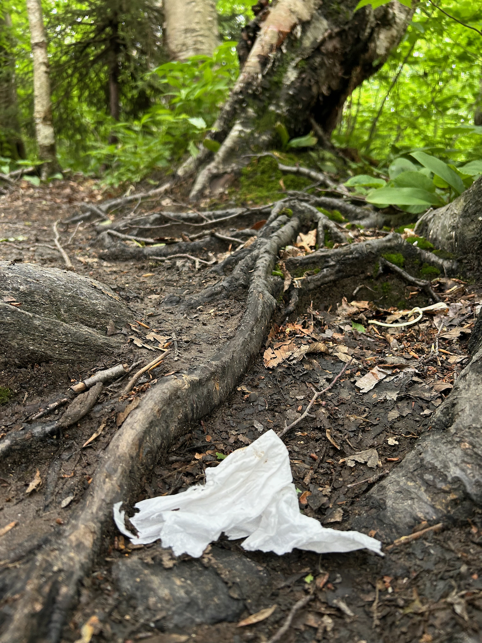
 

Leaving behind additional food sources for wildlife creates an imbalance that can inconvenience humans and wildlife alike. Moreover, these ‘compostable items’ degrade far less quickly than we might think (e.g. banana and orange peel can take up to two years to break down in nature). Animals are capable of fending for themselves, our food scraps leave unnecessary extra resources, which can ultimately compromise ecosystem integrity.


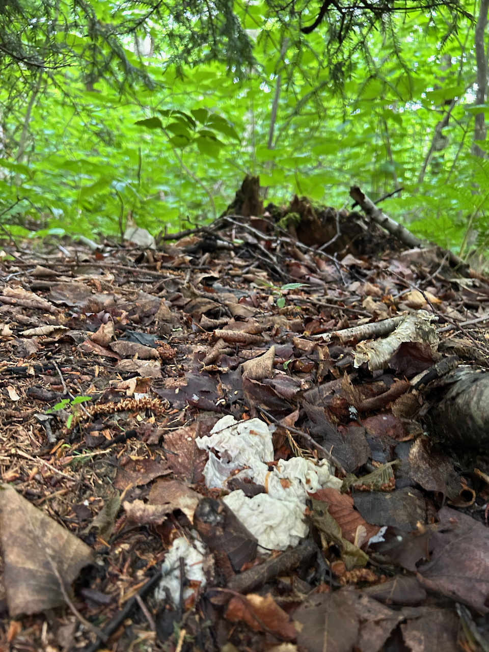
Lastly, on the list of “Not-So-Usual Suspects”, we have facial tissue and toilet paper. Tissues often fall into the category of “But… it’s biodegradable!”


But are they and does it matter?


For all the reasons mentioned above, it is not advised to toss tissue paper in the forest and it bears mentioning that contrary to popular belief… it will not dissolve into the soil anytime soon. Actually, if left to do its thing, a tissue left in nature can take anywhere between one and three years to decompose completely! Not to mention it contributes nothing of value to the ecosystem as it does so.


Pack In, Pack Out
It can be easy to fall into the way of thinking that one single action by one single person is “no big deal”. This is when we have to stop and remind ourselves that none of our actions are ever truly isolated. We are part of a vast (and growing) whole. The choices we make have an impact and the more people who decide to make a similar choice, the greater the impact positive or negative.


So what to do with anything that comes into the forest? Treat it all like trash. Treat it like a real threat to the ecosystem’s integrity and bring it back with you. Always have a bag handy in your hiking pack so you can contain the messier things. You can do the sorting (compost, recycling, garbage) when you get home, feeling pleased with yourself that you chose to invest in the future of that beautiful place you just visited. And if you want to be a major investor – feel free to pick up the slack and also commit to removing anything left behind by others (when it’s safe, of course).


We go to these natural spaces because we enjoy them and appreciate them as they are. By choosing to leave nothing behind, to bring it all back out with us, we are actively upholding an ecosystem’s integrity and this is as much a solemn pledge to the natural spaces as it is to ourselves.


References

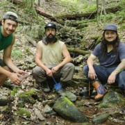
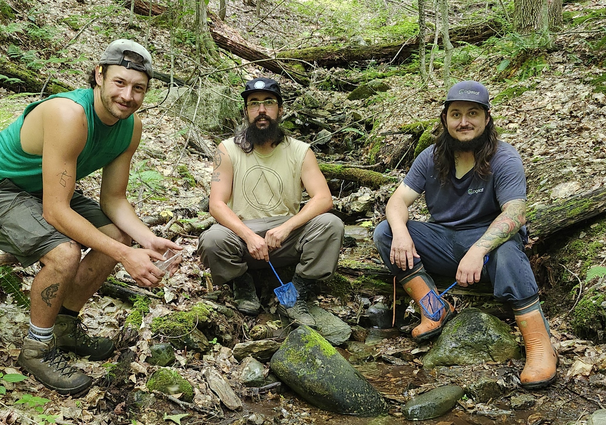
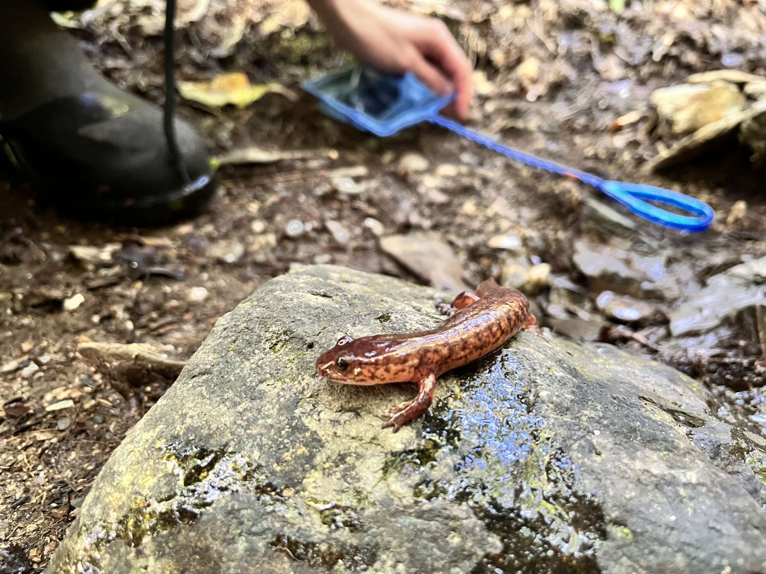
Recently, I had the pleasure of joining Nicolas Bousquet from COGESAF (Conseil de gouvernance des bassins versants de la rivière Saint-François) who came to our property for his annual salamander inspection. COGESAF monitors 2 sites on our property. They alternate their visits, making only one site per year to reduce pressure on sensitive habitat! Nicolas was accompanied by Charles and Félix, who came along with their nets and good energy. The day’s work was donated by COGESAF to the Nature Conservancy of Canada (NCC). The COGESAF team, along with other regional partners, all participate in the annual inspection of the 18 sites in the Eastern Townships. They share their findings with the CNC’s core research team, which is funding the 10-year project.

Salamandre a deux lignes

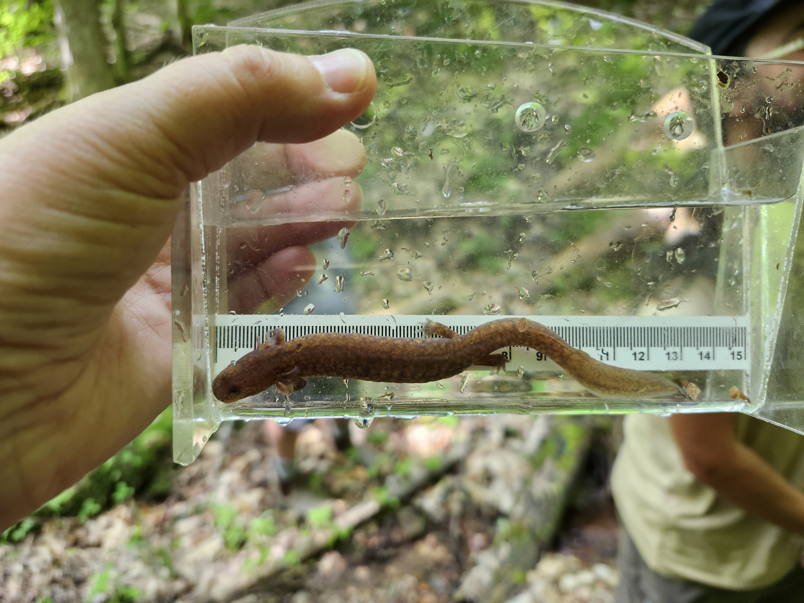
They observe the Northern Dusky salamander, the Spring salamander and the two-lined salamander, even if the last one has no status. They come every two years to check the habitat and count the salamander population in a specific 200-metre section of a stream on Massawippi Conservation Trust land.

The Trust’s property was chosen not only because of its habitat, but also because it was considered the control site against which the other results were to be judged. The site is rated 4 stars because it is on conserved or protected land, with little or no human interference, pollution or other man-made disturbance.

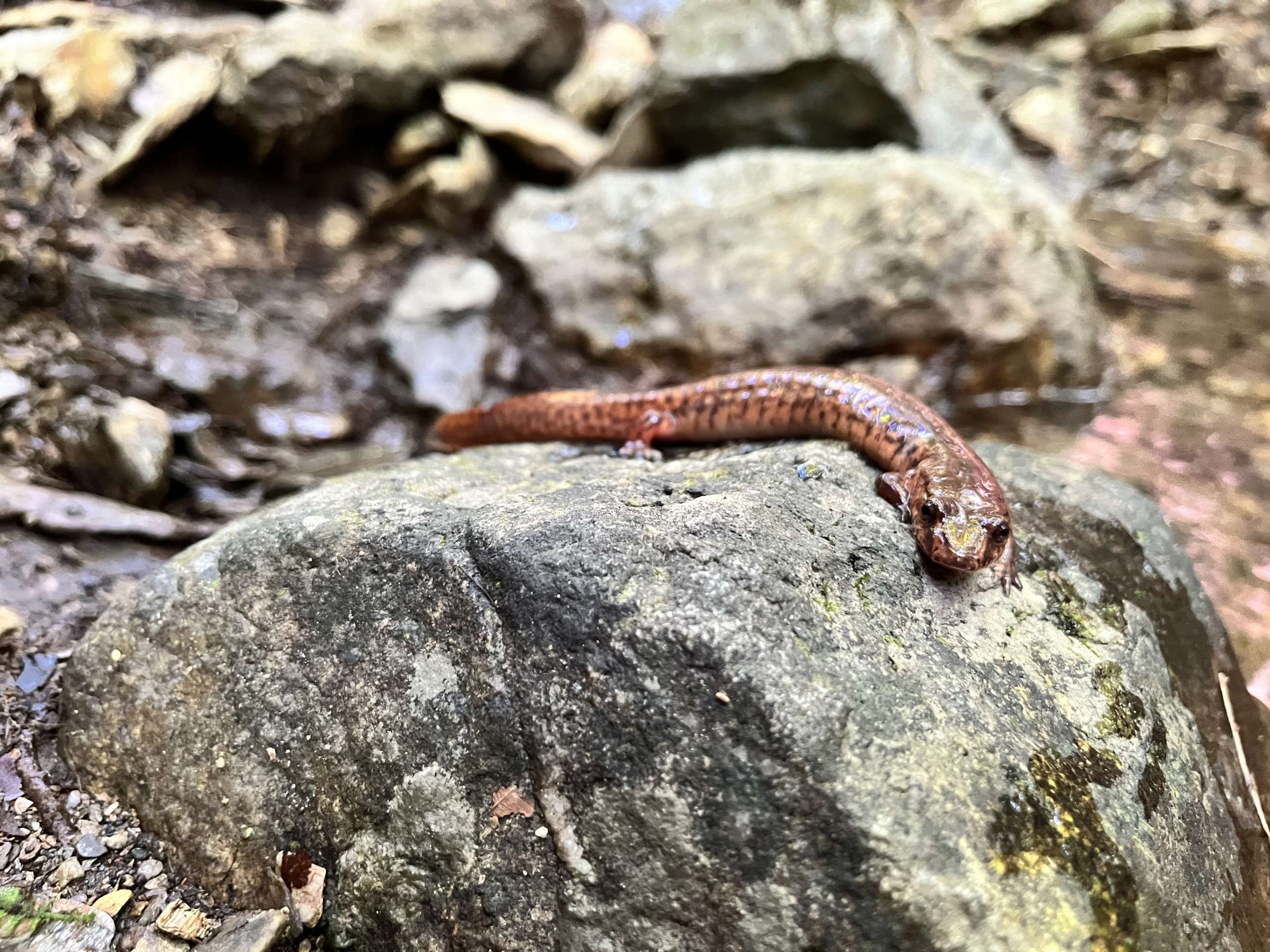
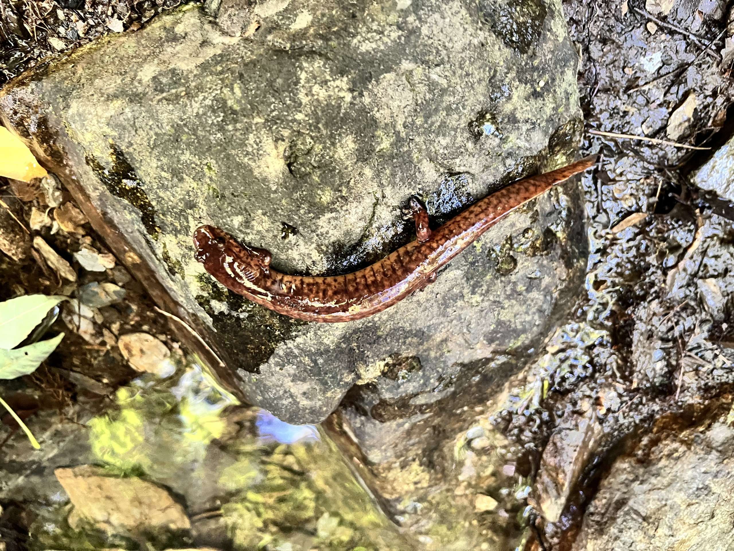
Salamandre pourpre or Spring Salamander

The salamanders (of which we have seen many varieties) are in an ideal location, living in and alongside a stream, which together with its surroundings is untouched, with cool, well-oxygenated water. In fact, the trees above the creek and in the riparian strip create top-quality habitat! There are only natural predators, including large purple salamanders that feed on smaller salamanders.

Salamandre pourpre or Spring Salamander

Don’t forget that salamanders are an indicator of a healthy habitat. These small creatures cannot survive in polluted or warm waters. The team found many salamanders on the trust’s land. Their numbers were good.

Charles, Félix, Nicolas from COGESAF / I love the fact that they have a competition among themselves to see who can identify the greatest number of species. They keep their lists in iNaturalist.

Our streams continue to be fresh and clean and flow with cool water to the lake, which is good for all of us, whether we’re four-legged or two-legged!

To find out more about salamanders, read Nicolas’ article. LINK

H. Hamel

Trails Essay – May 2024

by Matthew Cleary


I make hiking trails for a living. It is the best job in the whole world. We are not volunteers. We take our work very seriously. To build a hiking trail that lasts, that is safe, that encourages people to remain on the path and minimizes the damage our presence can cause on the sensitive ecosystems through which we pass, is long, often grueling work, but it is also one of the most rewarding and meaningful endeavors I can imagine doing. 


We all know the benefits of hiking trails, the effect spending time in nature can have on our physical and mental health, on our connectedness to nature, on our willingness to conserve and educate ourselves about the ecosystems that surround us. To be tasked with the job of making the forest accessible to visitors of diverse capacities and levels of experience is a responsibility we do not take lightly.


In this essay I intend to describe our process a bit, to explain the motivations behind the practical choices we make and the steps we take in the work we perform. We are, at times, land surveyors and lumberjacks, pack mules and stone masons, carpenters, gardeners, and landscapers. In the end, the trail must look like it emerged from the earth intact and whole, as if it had to be where it is and could not have been anywhere else. It takes a great deal of planning and work.  By the time the trail finally opens after months or years of blisters, sore backs, and ticks, we know every meter by heart, every turn, interesting rock, and grandmother tree. 


Once opened, a trail continues to evolve. It is rare that outside materials are introduced. Our building materials are typically found on site or nearby, and in building the trail, we have only changed the arrangement of the things we found in the forest, the soil, rocks, and wood. Once the trail is made, the plants and trees continue to grow. The earth continues to freeze and thaw with the seasons. The surrounding nature assimilates the trail in its new form. Ideally, the soil we have moved stabilizes, the roots we have disturbed heal, and the animals return or come out of hiding. 


I have been building hiking trails for the Massawippi Conservation Trust since the beginning. The creation of the Trust and its conservation and environmental education work ever since has been the result of countless wonderful people, and the list continues to grow. The land that has been spared from development and made accessible to the public through the network of hiking trails continues to be a gift to the community, now and for generations to come. I am honored to be involved, and lucky to have spent more time than anyone else in the world on the trails I have had so much fun building.


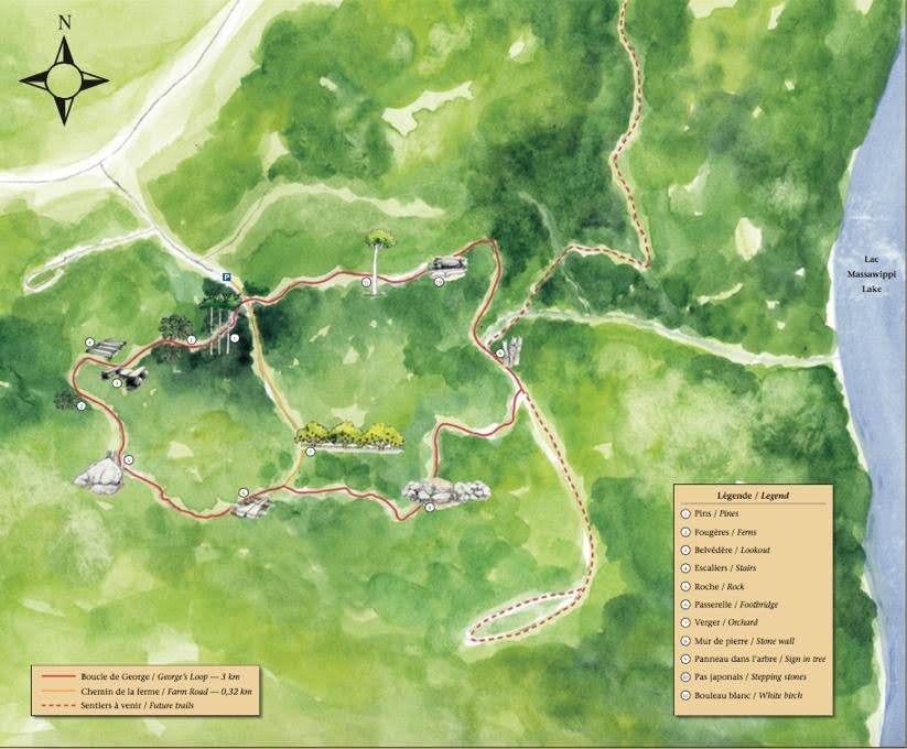
To describe our process more specifically, and anecdotally I suppose, I will tell the story from my perspective of the conceptualization and construction of George’s Loop. This was the first trail to open in the Wardman Sector of the Massawippi Trail. I have included maps, of the trail network then and now, to give an idea of our progress. The map will continue to grow. For those building these trails, the map serves as a diary. It is hard to look at it and not remember the stories associated with it. Here we began, at this turn. There is where we were when the leaves changed. That switchback was when Mahicans had his baby. Here it began to snow and we all stopped working at the same time and looked up to watch it fall.
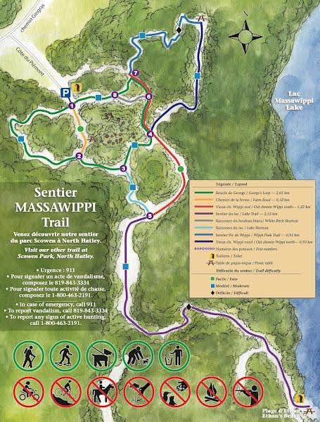


The first time I explored the forest the Wardman family had so generously donated to the Trust, I was with Mahicans Diamond, our fearless leader and trail consultant. I had fished in Lake Massawippi for years, but I had never really explored the forest covering the mountains on the west side of the lake. My first impression, not having seen its limits, was that the forest was vast and wild. I even carried my bear spray. In the first week, I saw the same fox several times and a porcupine in a tree waiting as we passed below. We also came across a few dear stands, a popular salt block, and the remnants of a truck from the 1940s in a ravine.

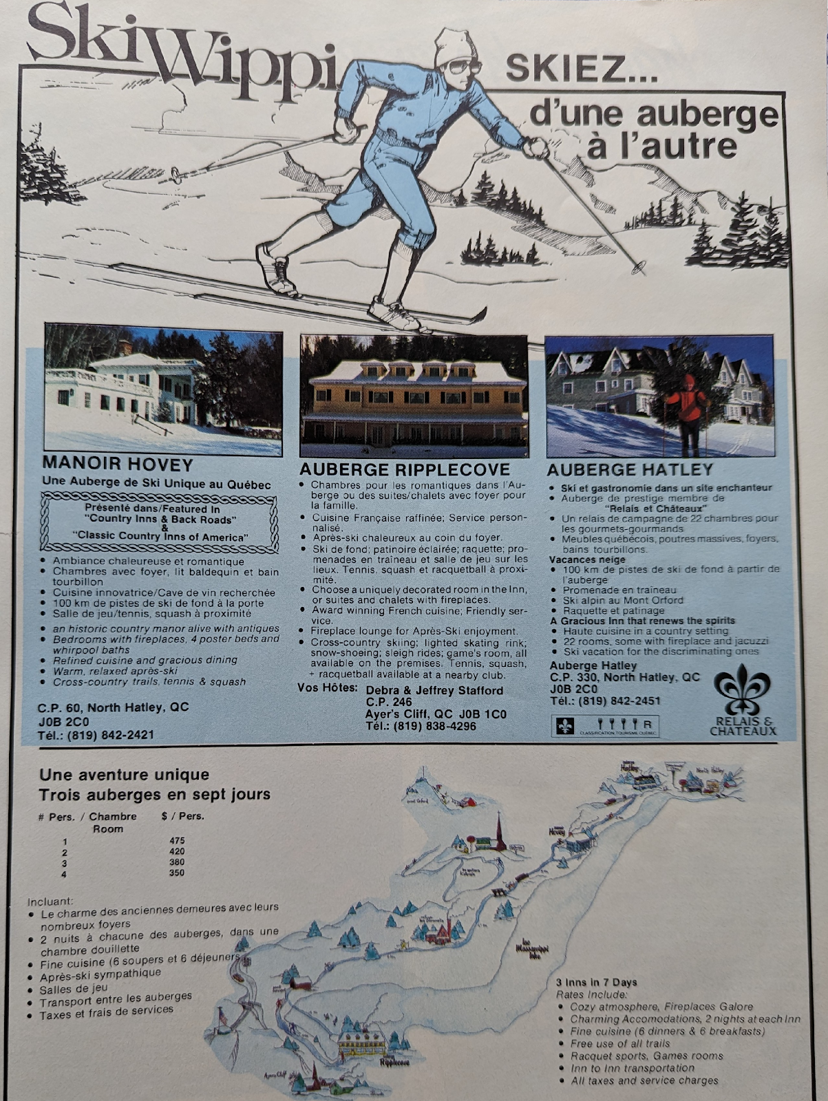
We parked at the end of Côte du Piémont where a large pile of gravel blocked the way on to where a farm used to be. The neighbors on both sides of the dead end were skeptical, and wondered aloud why would anyone in the world come here in the middle of nowhere to walk in the woods. It was not a virgin forest. There were a couple of old logging roads and four-wheeler tracks, and even a cross-country ski trail passed through that once linked North Hatley to Ayer’s Cliff before development and private property carried the day. An advertisement for the experience is included below. I suspect the prices are no longer valid.


In the case of George’s Loop, we had no Point A from which to start on our trek toward Point B. The mandate was simply to make the forest accessible to visitors of all comfort levels in the woods. There are many ways to build a hiking trail, with varying degrees of intervention, from a raised, wide path of stone dust with ditches on both sides and culverts allowing water to pass from one side to the other wherever necessary to prevent trail erosion. The other extreme involves simply clearing obstacles on the surface and walking on the forest floor as is. The first extreme is costly and limits the degree to which hikers feel part of nature when they hike. The second extreme quickly disappears if not used enough, and if used too much becomes a path of muck. The trail is beaten down by walkers as the network of capillary roots giving structure to the ground breaks down. Hikers avoid the lowest, wettest part of the trail in the center and the trail gets wider and wider as the process continues.
The most important decisions involved in building a trail occur at the beginning. I find it helps to explore an area in the spring when leaves do not obstruct the view of the contours of the terrain. To maintain a trail that hikers will choose to follow, trail erosion is our biggest concern. I try to imagine myself as a drop of water from rain or melted snow. Where would I go? Where would I stagnate? Building a trail is expensive. We have to imagine the absolute biggest rainstorm and flood that might happen in the next 20 years and prepare our trails against it if we want the trail to last 20 years. This is a bigger and bigger challenge as our weather has become more unpredictable and extreme.


After wandering the woods, getting a feel for what’s there, how humid it is, what sights and unique micro-ecosystems hikers might appreciate walking through, we begin to identify the trail corridor. This is an area about five meters wide where the trail will be built. If it is too steep, we plan to build stairs. If it is too humid, we plan to raise the walking surface somehow. The first pass is with a chainsaw. The hazardous trees are cut and the obstacles removed. If anything that is cut or found on the ground is large enough to use to build structures, trees or rocks, we leave it whole nearby and plan where and how we might use it.


The beginning of George’s Loop was easy. The trail gradually climbed as it passed through a plantation of widely spaced pine trees and the soil was relatively dry. Our trails are made with hard packed mineral soil. Vegetation has a harder time growing, and once the trail is compact, it is very durable and resistant to erosion if it is shaped correctly. We remove the organic layer of soil and bury it next to the trail in big pits we dig in search of deeper mineral soil. This is done with shovels or a machine. 


The trail must be crowned, higher in the center, to withstand the further compaction from hikers and weather and to avoid accumulating water. Ideally we find ridges on which to build the trail. Disturbed soil erodes much faster than soil with rooted vegetation and leaf litter, so the less contact our trail has with water the better. Even on flat terrain a trail must undulate in waves to avoid accumulating water, and the trough of each wave must have an outlet where water can run off the trail. 


We are meticulous in renaturalizing an area once we finish a section of trail. Disturbed soil erodes much faster than soil with rooted vegetation and leaf litter. We plant ferns. We spread leaves. We aspire to leave the forest as pristine as we found it. 


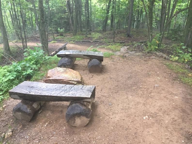
Past the pine stand and an area covered by mature maples and ferns, we arrived at our first summit. We built two benches out of a nearby maple that had fallen and managed to roll a rock up the hill the top to serve as a table. As a team we pry and roll our rocks with heavy iron bars we use as levers. Sisyphus would be proud.  Sometimes we use ropes and pullies to help fall trees or move rocks. These simple machines are often all we have access to and all we need.


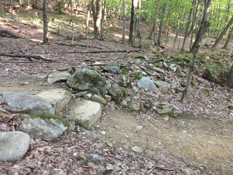
The descent from the first summit is a bit too steep for switchbacks alone to lessen the grade. We built terraced steps out of logs. We remove the bark with a hammer and cut a flat surface on each log. Removing the bark allows the log to dry and slows its decomposition. Each step is bordered by rocks to retain the mineral soil we fill inside. 


Sometimes the steps are made from large stones we find nearby. We use whatever is available and practical. Whenever we encounter a humid area we must cross, we canalize the crossing water between two large stones to allow hikers to step from one side to the other without muddying the water or their boots.


George’s Loop returns close to the site of a farm where there remains the stone foundation of the farmhouse with trees growing where the house once stood and a small clearing surrounded by apple trees. We found some abandoned tractor parts and horseshoes. I have heard the area used to be a sheep farm, but I cannot confirm it.

The trail continues down toward what used to be the Skiwippi trail, cutting through a straight, long pile of stones that once served as a fence or property line.
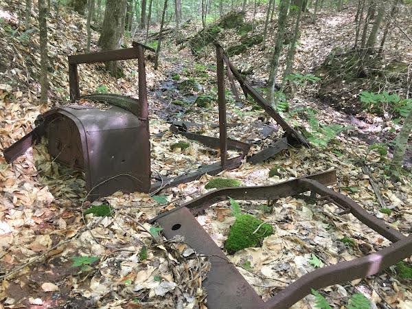
The section of George’s Loop along the Skiwippi trail is wide and flat, with ditches and culverts. In building the trail we found a metal wagon wheel. We left it in view leaning against a tree for hikers to marvel at as they passed. It wasn’t long before it disappeared. It is, no doubt, adorning someone’s garden now. There are other remnants of this path’s multiuse history. There is a kilometer marker being slowly swallowed by a tree, and it is on this trail that the rusty skeleton of a truck can be found.


It took us over a year to build George’s Loop. It takes about 45 minutes to walk it completely. Hiking gives a person a chance to think and reflect and decompress without the distraction of other people, without constant contact and the demands of our electronic devices. In other moments it allows us to be completely present with those friends and family around us. The land here has had many uses over the years, dating back thousands of years, but whatever it has meant for people living nearby, its importance as a store of carbon and a home for plants and animals remains. We must remember that we are guests in the forest, and strive to act as its protectors as best we can.
Fire and Fire Prevention

We are becoming more and more aware and affected by fire. Living near a forest, an open field of dried grass, an old wooden barn, shed or a house, we worry about fire. What can we do to help prevent it? How can we protect ourselves and our homes?

There are many local sources of information and to help you we have quoted some information for you here.

In March, the Régie de l’incendie Memphremagog Est distributed an information brochure. IN it and on their website, you will find the rules governing outdoor fires, those in your backyard in prefabricated fireplaces and open fires, along with advice about how to protect your home, build an evacuation plan and much more.

Backyard fires in a contained prefabricated fireplaces can be enjoyed under the following conditions, without a permit: 

There is an adequate physical barrier (spark arrester or protective screen), a maximum dimension of 27 cubic feet ((ft ‘) 3ft X 3ft X 3ft), and it is resting on a gravel base and not adjoining a building, that complies with the installation standards set out in article 51 and whose smoke does not disturb neighbours. Winds must be under 20km per hour.

The fire place must be 

  1. 5 metres (m) from a main building; 
  2. 5 metres (m) from an accessory building; 
  3. 3 metres (m) from a property line; 
  4. 3 metres (m) from any shrub or arborescent vegetation


Outdoor fires, sometimes called campfires or open-air fires, have a different set of rules. These fires require a permit. Contact the Régie de l’Incendies Est if you live in the MRC of Memphremagog. Contact 873 289 5886 www.regieincendieest.ca. You need a permit to burn branches and wood. You are not allowed to burn leaves, grass, construction materials, garbage etc.

The rules are:

  1. Have authorization or have received a permit from the competent authority;
  2. All outdoor fires are prohibited when the flammability index announced by the Société de protection des forêts contre le feu (SOPEU) for the Estrie region is high, very high or extreme; 
  3. Keep a responsible adult at the fire scene at all times; 
  4. Keep the necessary equipment close to the fire at all times to prevent it spreading; 
  5. Keep the fire under control at all times; 
  6. Do not use flammable liquids (petrol or other) to start or activate the fire; 
  7. Do not light or keep lit any fire if the wind velocity exceeds 20KM;
  8. No flammable liquids should be in the vicinity of the fire; 
  9. Ensure that smoke and ashes do not spread;
  10. The fire must be extinguished before the person responsible leaves the premises; 
  11. Do not use any of the following materials as fuel: plastics of any kind, tires or other rubber-based materials, construction/demolition waste, hazardous or polluting products, hydrocarbons, household waste, garbage, varnished or painted wood or any other product whose combustion is prohibited by municipal and provincial laws and regulations, etc.

SOPFEU is our Quebec Wide emergency Fire service. They have an excellent website which contains additional information. SOPFEU.QC.CA

Download their Protect your home brochure which includes 12 ways to protect your home. https://sopfeu.qc.ca/wp-content/uploads/2024/05/SOPFEU-Protect-your-home-flyer_202405-1.pdf

There is a second brochure called Firesmart Begins at home with more in depth information.

https://sopfeu.qc.ca/wp-content/uploads/2023/12/Begins_at_Home_Guide-With_Self_Assessment-SOPFEU-WEB.pdf

Tips from the pros! Download the SOPFEU mobile app (available for iOS and Android) to get automatic alerts when the fire danger level in your area exceeds “high.”

When smoking:

While in the woods or anywhere outdoors, do not smoke while walking around. Do not extinguish your cigarette butt in soil and leave it there. Did you know cigarette butts are an important cause of forest fires especially when the vegetation is dry?

According to SOPFEU, If you smoke in the forest, you must discard all residue properly. Between April 1 and November 15, smoking in or near a forest is prohibited, whether you are working or travelling, unless you are in a building or a closed vehicle.

  • In order to avoid any risk, do not smoke while walking; find a clear area and stop while you smoke.
  • Extinguish your cigarette butt in water or stub it out on a rock. Discard it in a place intended for this purpose

It can take up to 4 or 5 hours from the time a cigarette is crushed to the time the first flame appears. That’s why the Régie incendie Memphrémagog Est reminds you to be vigilant when you put out your cigarettes. If you have to extinguish a cigarette butt outdoors at home, use an ashtray that is protected from the wind and placed on a stable surface.

A friendly reminder: NO FIRES are allowed on our conserved properties, including Ethan`s Beach.

Get informed and stay safe. Together we can help mitigate the danger.

Written by Jessica Adams (Nature Nerding)
Reading time: 5-6 minutes

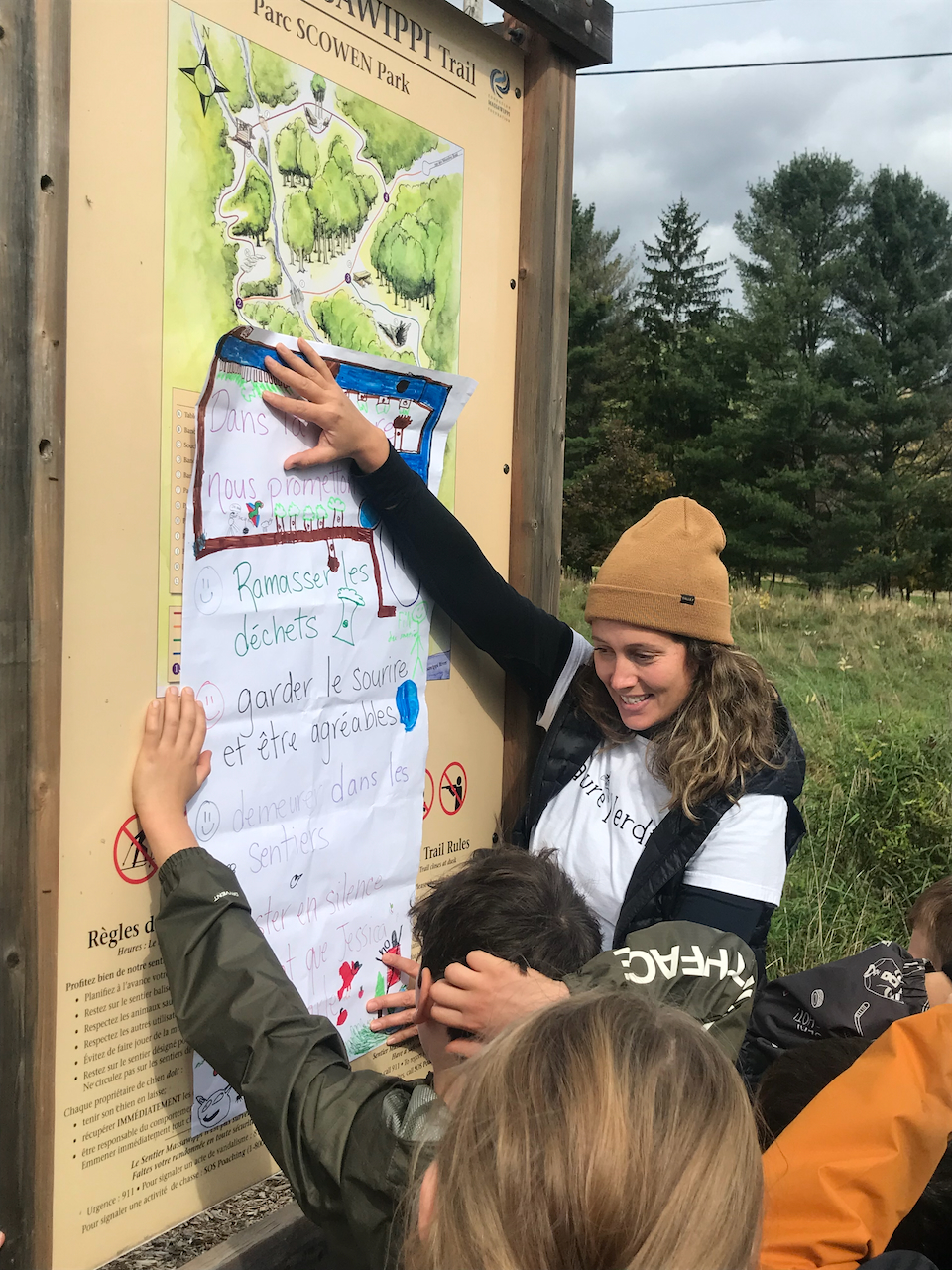
We start every outing of the Massawippi Foundation’s Nature Education Program by gathering around the Scowen Park map. Once we are all huddled in close together, we take the time to say hello, to look back on our outing last season, and to revisit the guidelines to follow for a safe and respectful outing. When it comes to this last part, students proudly chime in with their take on “how to be” as we are walking through the forest. By the winter outing (the second of three throughout the school year), students are pretty clear not only on what the expectations are, but why they exist in the first place.

We make this discussion a priority not to restrict enjoyment, but to expand awareness. The idea is for these children to form an understanding of the part they play in a bigger system of interconnected beings. The message is that their actions matter. The hope is this will encourage new ways of thinking that will stick with them for a lifetime and influence their future interactions with the natural world.


This is the first in a series of articles meant to start a conversation around the principles underlying the guidelines common to so many trail networks. With the number of people enjoying the outdoors on the rise, it is more important than ever to view park guidelines not as limiting regulations, but as opportunities to mitigate our impact and be part of ensuring the natural environments we love so dearly continue to thrive for generations to come.

Part 1: Honouring the Trail

Trails as Pathways for Recreation & Conservation

“One of the main challenges of the planning, design, and management of natural areas is making decisions that will produce the best quality user experience, while protecting the ecological integrity of the resource base.” (Lynn and Brown, 2003)


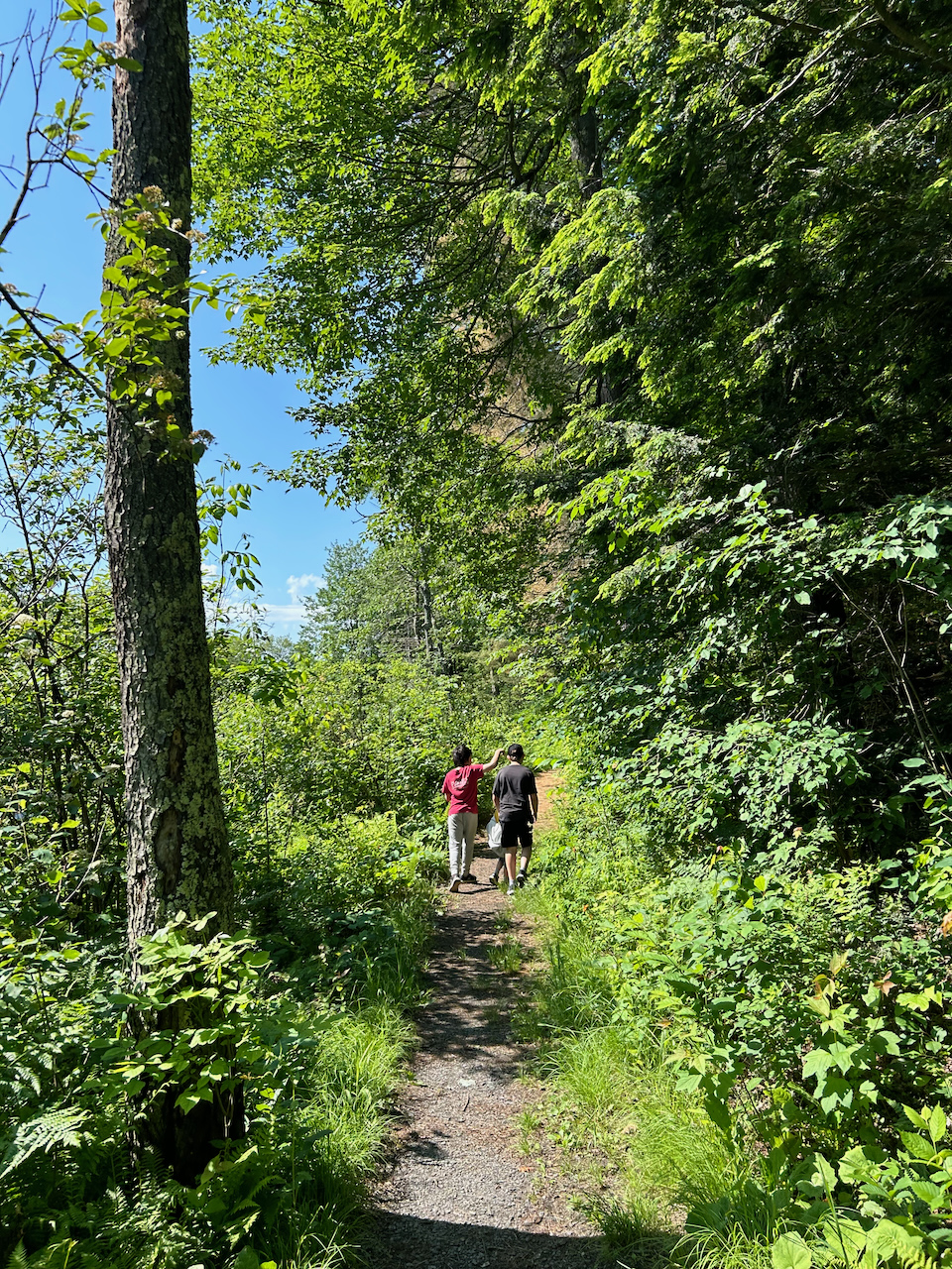
Trails are one of the main vehicles for encouraging nature-based tourism. People walk and hike through nature for a variety of reasons, not least of which are the physical and mental benefits we experience by moving and breathing outdoors. There is little doubt as to the benefits trails have on their users… but is there potentially a benefit to the natural areas themselves? Indeed there is. The idea of conserving nature might not factor on the list of top priorities if individuals have never had the chance to experience it firsthand. To know something is to develop a love for it and, naturally, a desire to protect it. Trails provide access to natural areas where it might not have been granted otherwise, providing opportunities to build a relationship with the natural world.
 

How we enjoy this access to nature, however, can have consequences. If enjoyed in a way that is mindful, having access to nature will not only have a smaller impact on the surrounding ecosystems, but can be a gamechanger when it comes to connecting people with nature and encouraging pro-conservation attitudes. Conversely, if this access is enjoyed in a way that is careless, the impacts on the habitats through which the trails run could be potentially devastating.

The way the pendulum swings is up to every individual who sets foot on a trail. So what does it look like to enjoy a walk in the woods in a way that is mindful?


Trails Built with Intention

A lot that goes into building a trail. When done properly, everything is taken into consideration, from the trajectory it takes through the forest to the types of tools used. Generally, trails are designed to:

  • respect the natural area through which they run, meanwhile showcasing some of its most stunning features
  • withstand a reasonable amount of wear and tear (from walkers and from the elements)
  • keep trail users safe and on-track

In short, trails are built for enjoyment with hiker safety and conservation top of mind.

Sometimes we venture off trail because we want to see something up close, take a shortcut or find a more private lookout point…. As tempting as it might be and as harmless as it might seem, let’s consider the advantages of staying on trail.


By enjoying the trail and keeping to it, we avoid exposing ourselves to additional risks, such as:

  • Getting lost. “Wandering off trail is the number one reason, ahead of injury and bad weather, that adult hikers require search and rescue.” (Moye, 2019) Accidentally losing the trail can happen to the best of us, but whether on purpose or not, a stroll off into the forest can last longer than we’d like and potentially evolve into a serious ordeal.
  • Sustaining injuries. Trails are carefully built so walkers can get around with less risk of injury. They skirt more challenging and potentially dangerous terrain and have features like steps and boardwalks for areas that are trickier to navigate.
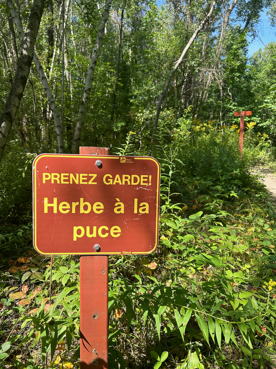
  • Rashes or burns. Trails are generally cleared of vegetation which means we are less likely to brush against Stinging Nettle, Poison Ivy or other plants with neat (but unpleasant) defense mechanisms.
  • Bites. Ticks don’t hang out in mud or gravel, but they do hang out in tall grass and leaf litter! Staying in the trail keeps them at a more comfortable distance and decreases the chances of one hitching a ride home with us.

Presumably, those of us who favour trail walking do so because of the beautiful environment. By enjoying the trail and keeping to it, we preserve the natural areas around us by:

  • Protecting sensitive and vulnerable life. This can range from avoiding stepping on plants to avoiding leaving behind our human smell that might signal danger (and cause undue stress) to critters living in the forest.
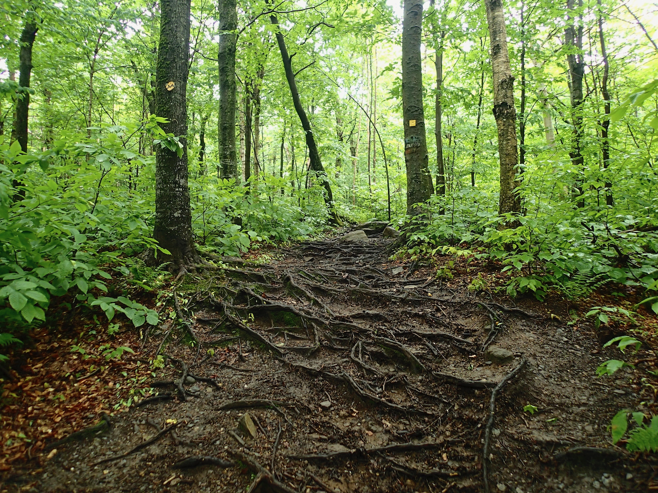
  • Maintaining the soil’s porosity and resistance to erosion: Untouched soil on the forest floor is protected by layers of plantlife and organic matter and has a certain absorbency when it rains. If the same areas are trampled time and time again, the top layers of the forest floor recede, revealing the soil beneath. With more trampling, this earth is compacted over time. Not only can water no longer be absorbed, but water running over it gradually erodes the surface, washing away soil particles and important nutrients.
  • Preserving the habitat integrity: The more traffic an area sees, the less favourable the soil is for new life to anchor in and get growing. Little by little, this can limit plant growth and the diversity of species.


The opening discussion with students can go in a variety of directions, but we always come back to the notion that guidelines don’t exist to take away the fun, but to protect the natural areas we love so much. A reframe, if you will: by not doing something small… we are doing something big. By choosing to stay on the trail we are taking responsibility for our safety and we are actively investing in the health of the places we are visiting. As visitors, we are part of the natural systems, even if for a brief moment, and we get to choose whether our impact is positive or negative. How wonderfully empowering.

Stay tuned for more information on other common guidelines and how they help us protect the natural areas we enjoy.


References

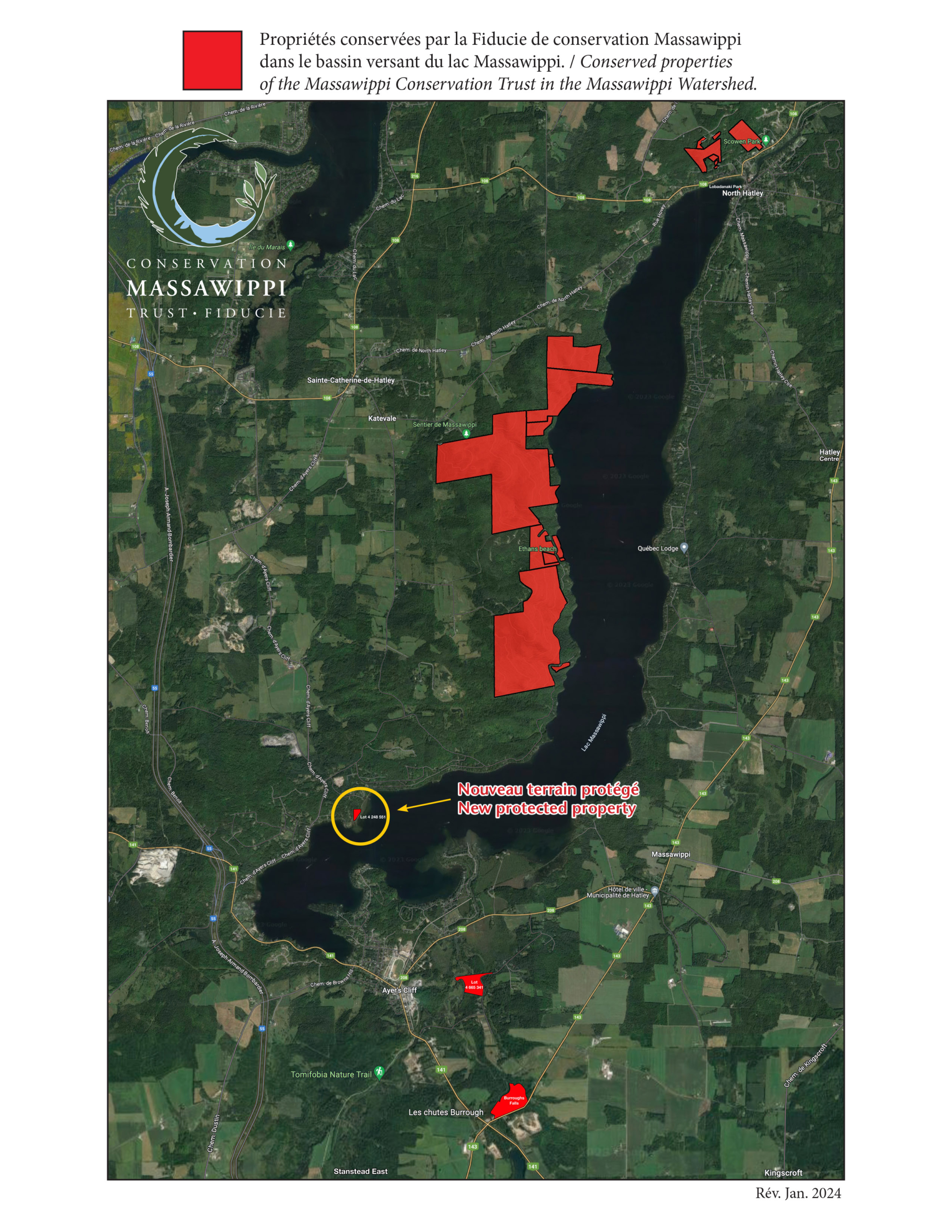
We are pleased to announce that we have acquired a new property to protect in perpetuity and helped Blue Massawippi at the same time by purchasing this property which will give Blue Massawippi an infusion of cash for their important work on the lake. We would like to thank Christine Crowe and Denis Peticlerc along with MCT Trustee Margot Graham Heyerhoff who signed the deed of sale on December 19th, 2023.

Long before the Trust was established, Lake Massawippi Water Protection Inc. (Blue Massawippi) was given this 3-acre lot on the lakefront because the owner wanted to see it protected.  It is zoned ‘white’(developable). Had the MCT existed at the time, the Trust would have been the recipient of the land as Blue Massawippi does not have a mission to conserve and protect land in perpetuity.  Its mission is to protect the health and water quality of the lake. They work on issues such as invasive species such as zebra mussels, the recurring blue-green algae causes, and many other lake issues.  Blue Massawippi needs to focus all of its attention on the lake.

The members of Blue’s Board of Directors were very happy to know that this wetland, a carbon-capture environment close to Lake Massawippi, will, thanks to this transaction, be protected in perpetuity and thus continue forever to play its role as a natural habitat for flora and fauna. In addition, during periods of high water, it will help regulate the water level of Lake Massawippi. 

The Trust protects land adjacent to Lake Massawippi and its tributaries by:

  • Acquiring land through either purchase or donation 

– We purchased the wetland from Blue.

  • Establishing servitudes on land

– We have several properties under servitude and others being added in the near future.

  • Helping landowners understand the ecological and tax benefits of limiting the types of activities permitted on their properties.

– Access to the expertise of Corridor Appalachien as a member organization.

  • Helping landowners understand the potentially disastrous effect of over-development on the overall well-being of the Massawippi watershed. 

– As witnessed by residents and visitors alike, the protected green ridge has had a positive effect on the quality of life on the lake due to the many streams that flow into the lake that will never be disturbed.

How do the two organizations work side by side? 

What are the differences?

See below how we complement each other.

Massawippi Conservation Trust (LAND) Blue Massawippi (WATER)
Est in 2011 as a registered Canadian charity. Est in 1968 as a registered Canadian charity.
Mission : To conserve the natural state of the land adjacent to Lake Massawippi and its tributaries, and to provide stewardship services for that land in perpetuity. Mission : To inform, educate, influence and act on environmental issues that threaten water quality, the health of Lake Massawippi and the quality of life of its residents and users.
Description : The Massawippi Conservation Trust (MCT) was established to conserve land adjacent to Lake Massawippi and its tributaries and provide stewardship services in perpetuity. Starting with the lands on the western ridge of the lake because the government of Quebec identified this particular area as containing old growth forest with a rich biodiversity, including rare and endangered flora and fauna documented by biologists from Appalachian Corridor Association The Trust is now expanding its conservation efforts to include wetlands and agricultural lands in the entire watershed.

It is a registered not-for-profit organization that can issue tax receipts for donations.

Description : Bleu Massawippi is an organization dedicated to preserving and improving the ecosystem health of Lake Massawippi and its watershed. It works in close collaboration with its various partners, applying its very limited, non-coercive powers to ensure constant vigilance over conditions that threaten water quality, and to raise awareness among users, municipalities and government bodies of best practices based on scientific evidence. With its capacity to mobilize citizens, its credibility with regulatory authorities and the support of its partners, Bleu Massawippi is setting up structuring initiatives for the protection and conservation of Lake Massawippi with the objective of contributing directly and sustainably to the quality of life of users and the community.
Its sister organization, the Fondation Massawippi Foundation (FMF) whose mission is to:

  1. Preserve the Massawippi Valley’s unique ecosystem; 
  2. Fundraise and principally, but not exclusively, financially support the Massawippi Conservation Trust in its operations; 
  3. Support community-based initiatives that are ecologically, socially, culturally and/or educationally valuable to the Massawippi Valley. 
  4. As a fund within the Ottawa Community Foundation, it can also receive charitable donations directly.
  5. The FMF and MCT are focused on the land in the watershed of Lake Massawippi, an area of 586 square kilometers.
Blue Massawippi was incorporated as the Lake Massawippi Water Protection Inc.

It is a registered not-for-profit organization that can issue tax receipts for donations.


It’s mission is:

To inform, educate, influence and act on environmental issues that threaten water quality, the health of Lake Massawippi and the quality of life of its residents and users.

The lake has an area of 18.7 km2 and a perimeter of 38 km.


The land contains 2 rivers, countless streams and tributaries as well as underground water that all flow into the lake. By protecting the land in the watershed we are helping to reduce the flow of sediments and pollutants into the lake. The lake is the main source of drinking water for several communities as well as a biodiverse body of water at the center of 5 communities and a major tourist attraction for the region.
The Trust has added 12+ kms of natural trails to our protected properties in order to give the general public free access to the benefits of walking in nature. One trail goes down to the lake via Ethan’s Beach. 

The Foundation sponsors an outdoor education program which takes place at Scowen Park

With a target of 5 tonnes in 3 years, Bleu Massawippi devotes four weeks a year to removing the waste in the lake with a team of divers. 

A grand total of 4885 pounds (2216kg) of tires, bottles, car parts and concrete blocks and other objects were collected in 2023. It’s primary focus is the removal or reduction of zebra mussels, an invasive species.

The MCT authorizes research activities on its lands, which are part of the 4 tenets of conservation which it follows: Protection, Research, Recreation, Education.   Blue Massawippi runs an education program for boaters in order to help reduce or prevent invasive species from entering the lake, to provide a better control on conserving the riparian strip, and help keep the boaters safe
Current projects of the Massawippi Conservation Trust: 

● Agricultural research project with master’s students from Bishops University 

● 2 scientific studies in progress on our protected properties.

● A nature education program currently for students from grades 3 & 4. 

● Project 27. A targeted conservation project aimed to protect over 785 acres of vital wetlands at the southern end of Lake Massawippi. These lands are the kidneys of the lake.

Current priorities: Control zebra mussels in the lake and removal of veligers (scientific study ongoing)

  • Developing a scientific diving program 
  • Waste removal in the lake
  • Revegetation of the Tomifobia river
  • A scientific study of the lake currents
  • Water quality surveys

Sometimes people confuse the two organizations, thinking that we are one and the same, or they ask why we don’t merge.


The answer is simple. We each have our sphere of influence and focus so that we can accomplish parallel goals. There is a tremendous amount of work to be done to protect the land and the lake for our community.  Each entity is able to focus all of its resources and energy on the mandate established at the time of their founding. Each of us are specialists in our own domains, effectively working to protect the valley we love, be it land or be it water.


What an exciting place to learn about history from a cultural, industrial, environmental and anthropological point of view.

In September, the Massawippi Conservation Trust signed a deed of servitude with the municipality of Stanstead East in order to protect the land immediately adjacent to the falls. This land and the Niger river that flows through it, have been central to our local history for thousands of years. They are in the Appalachian geological corridor of Quebec. 

This is the traditional territory of the Abenaki people. Thanks to recent archaeological digs, we have concrete evidence of their passage and presence along the Niger River. Abenaki archaeologists have studied the land above the falls all the way back to Lake Lyster from where it flows. The flat plains were good for hunting and fishing, a dry place for the semi-nomadic people to move through season after season. The river was the passageway to travel from the south to Lake Massawippi, another rich hunting and fishing ground. 

“We had a cursory archaeological dig done to see what was on the Abenaki territory. We found a striker that dates back thousands of years. We also found quartz from Mount Pinnacle,”  recounted Pamela B. Steen, municipal councilor (now Mayor) in La Tribune April 2021 article. Quartz was a type of mineral that was used for barter. 

Zoom forward past the arrival of the French and English fur traders to the period of colonial settlement. Other people started arriving in the region in the latter half of the 1700s. Some were Europeans, others had official land grants and many arrived on foot, from the northeastern United States, people who were in search of land. Like those before them, the settlers recognised the river as a rich source of food, transportation and power.  We do not know much about the Tatton family, a black family that came here in 1804. But it seems that the river, originally called the Negro River, derived its name from them. The river`s name changed over time from Negro to Nigger and finally to the Niger River. The current name “Niger River” is first reported in 1863 on the Map of the “District of St Francis (Putnam and Gray)”. The word “niger” comes from the Latin form of “black”. The toponym “rivière Niger” was made official on September 14, 2006, at the Commission de toponymie du Québec. 

One man, Stephen Burroughs, famous for his ability to adapt to the times, became the namesake of the falls. His infamy comes from his skills as a counterfeiter. He was born in New Hampshire in 1765 and according to his own memoires was `the worst boy in town`. He was a swindler and prankster. During the American revolution he impersonated a doctor when he shipped out on a Yankee privateer. Later he stole his father`s sermons (his father was a Presbyterian minister) in Massachusetts and he impersonated a preacher performing marriages, baptisms and more. Finally, he saw a potential in counterfeiting coins and paper money. He eventually ended up in Stanstead Township in 1799 with his wife Sally and their children. Like others, he cleared land and built saw and grist mills. He was possibly the first to build a mill on the river. He was well regarded  by his neighbours. The colourful story of his life is well documented in American and Canadian articles (see bibliography below).

Throughout the 19th and early 20th centuries, the site passed through several hands as agriculture and forestry formed the basis of the economy in northern Stanstead Township. In 1854, a sawmill, a blacksmith shop, a bridge and farm buildings were located near the site. Just above the falls, a house was built between 1883 and 1906, accompanied by a barn-stable. Evidence of these human activities have been corroborated by archaeologists.
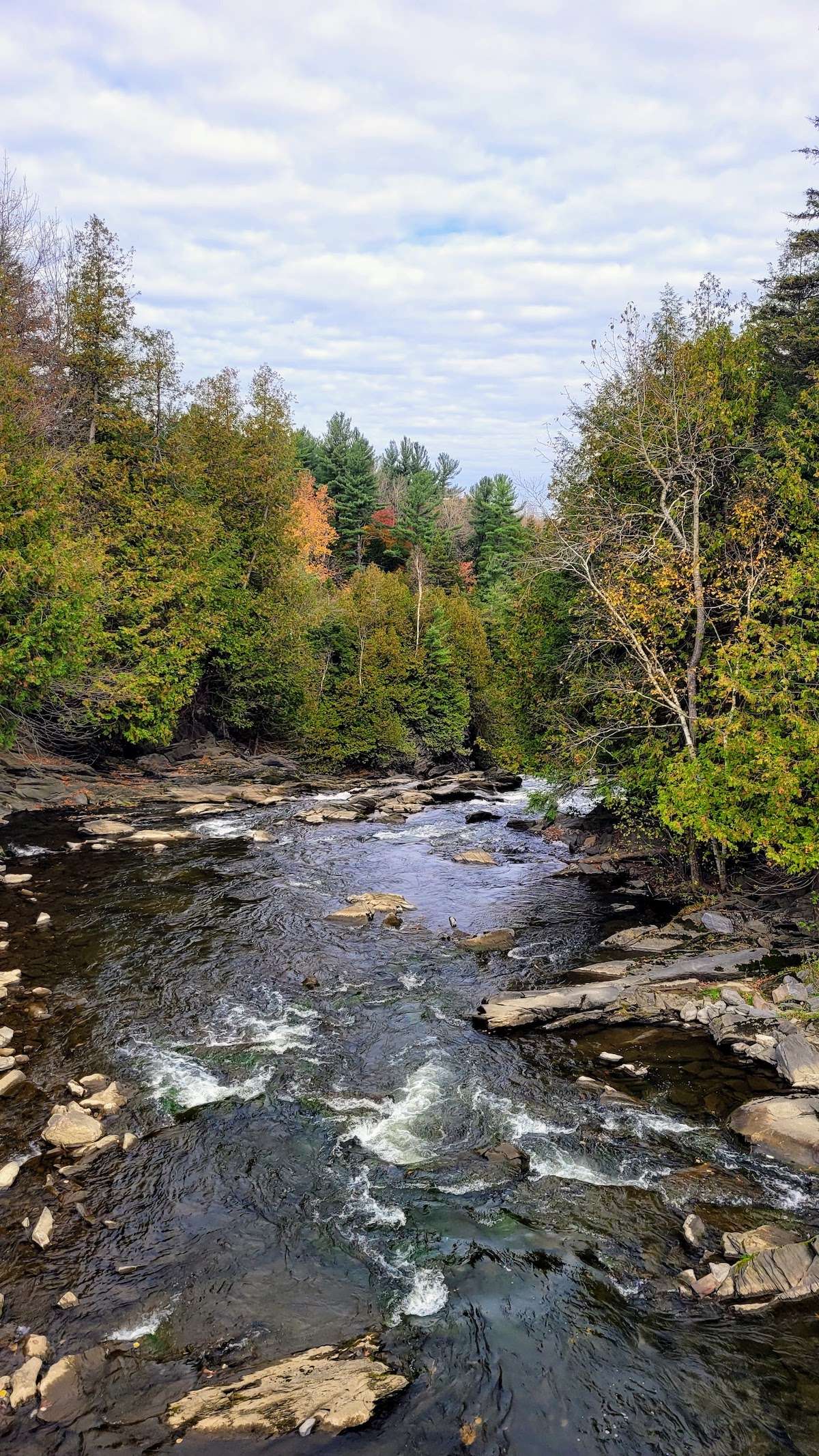
Another important part of the history of Burrough`s Falls is it`s hydro power. The Niger River had many mills along its banks and in 1929 a hydro station was built by Southern Canada Power Ltd (SCP). There was a 2,000 HorsePower mill operating in 1930 according to the SCP annual report. 

The construction of this small power station was of strategic importance to Southern Canada Power Company, which wanted to be closer to the industrial development of Rock Island, which was more than 100 km from the Chute-Hemming power station. What’s more, the new power station would also make it possible to secure the southern grid in the event of a power distribution problem.

With the nationalization of Quebec’s hydroelectric network in 1963, the power station became the property of Hydro-Québec. In the 1980s, several installations were dismantled, including the barn.

In 2010, a major break occurred in the penstock, resulting in the permanent shutdown of electricity production. Between 2014 and 2016, the balance stack and penstock were dismantled.

In 2021 the municipality of Stanstead East acquired the site from Hydro Quebec for future recreational purposes and to protect it from further transformations.  It had the hydro station recognised and registered as a heritage building.

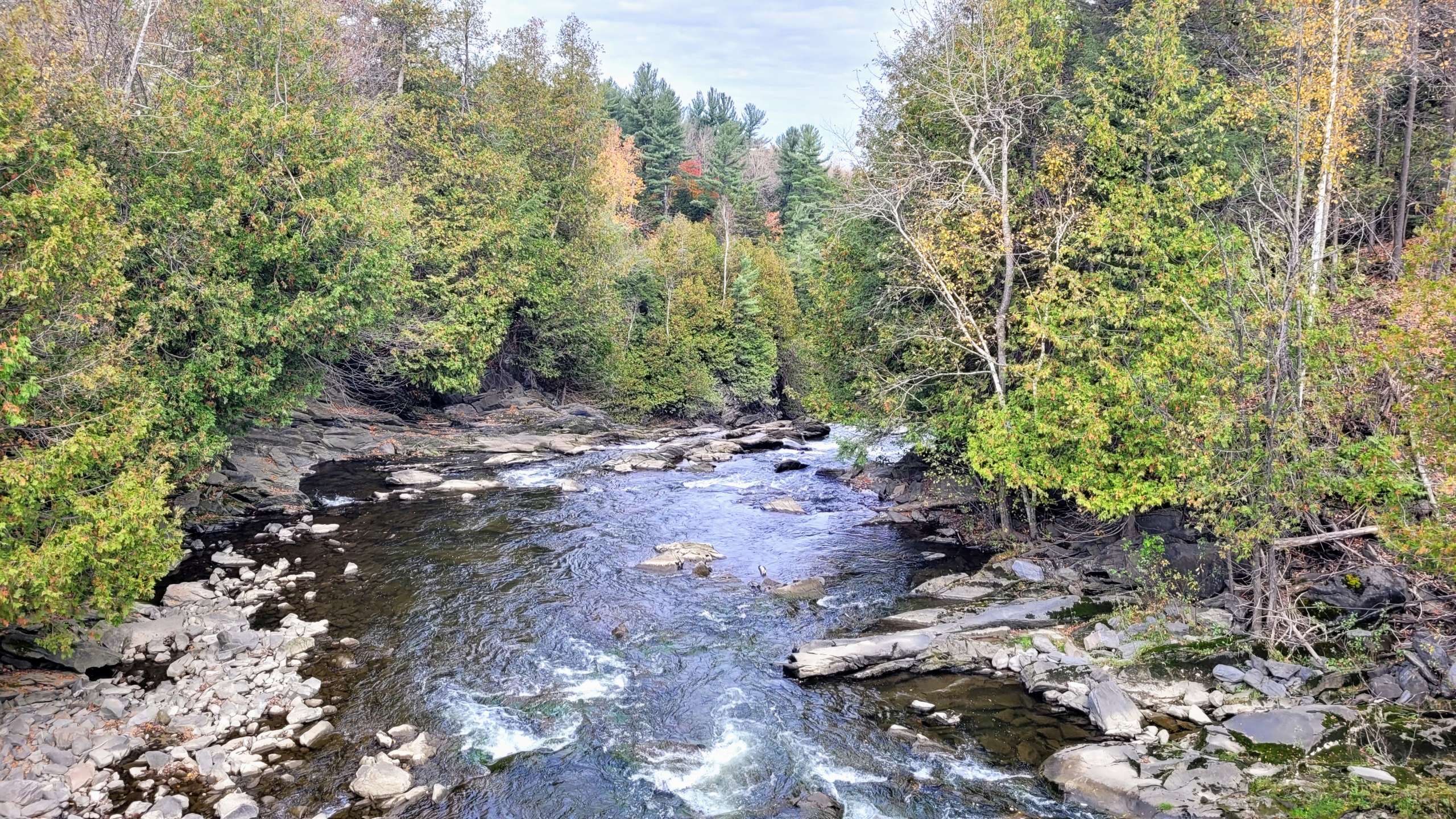
The heritage site is also of interest for its landscape value. The site is marked by the presence of the 55.17 m-high Burroughs Falls, part of the Niger River. The property, which is largely wooded, also features several types of forest stands: cedar, hemlock, maple, and tall pines planted along the access road.  
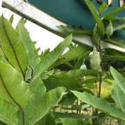
The newly renamed property, Parc des Chutes-Burroughs, is home to several types of habitat: forest environments; aquatic habitats comprising the Rivière Niger, its waterfalls and certain streams; and treed swamps, some of which are located in flood-prone areas. Some streams are home to a species of salamander likely to be designated threatened or vulnerable in Quebec, the Northern Dusky Salamander.

As for the plant species present, Canada fleabane, two-leaved toothwort and ostrich fern matteuccia are species vulnerable to harvesting, while Provancher’s fleabane is a threatened species in Quebec.

In September 2023 the Massawippi Conservation Trust signed a conservation servitude to protect the 36 acre property in perpetuity. Part of the site will continue to thrive as a park and recreational area. The municipality intends to open the space to visitors with an exhibit at the hydro station and allow walkers to enjoy the forests and river`s edge in late 2024 or early 2025.


Bibliography

https://www.latribune.ca/2021/04/10/un-joyau-devient-un-espace-vert-a-stanstead-est-068577b65b9de4f165e35595aa3b9720/

https://www.patrimoine-culturel.gouv.qc.ca/detail.do?methode=consulter&id=233557&type=bien

https://www.latribune.ca/2022/08/18/decouvrir-le-territoire-ancestral-des-abenakis-via-les-chutes-burroughs-7ed7064d9646021869974d41a97bcbab/

https://www.google.ca/books/edition/Forests_and_Clearings_The_History_of_Sta/IFDHswdhWqwC?hl=en&gbpv=1 

https://cantondehatley.ca/en/information/about-hatley-township/


Written by Jessica Adams (Nature Nerding)
Reading time: 5-6 minutes

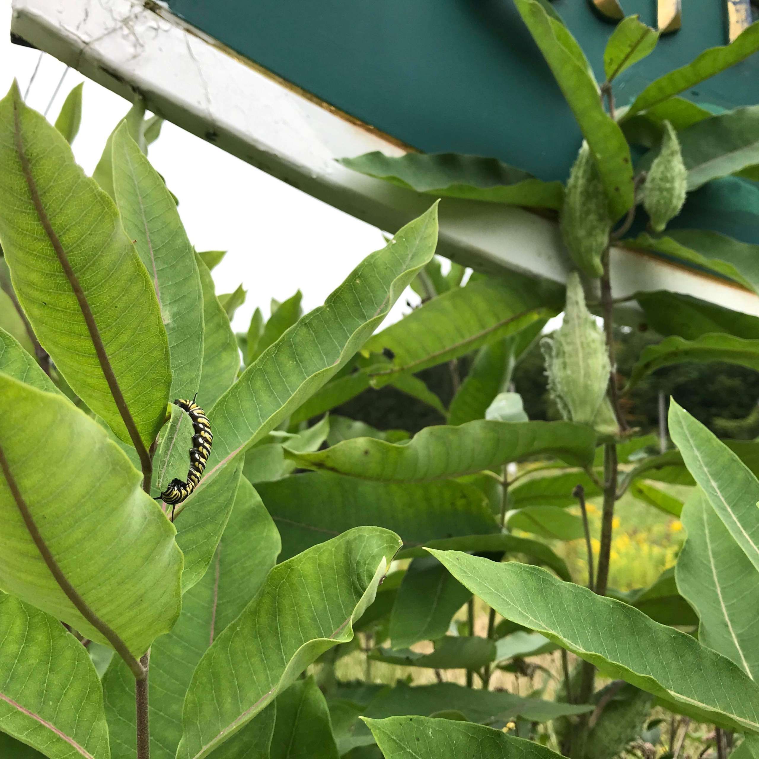
(Ph: Guillaume Levesque)  Though we didn’t have any luck finding Monarch eggs or caterpillars at Scowen, following our “Monarch Moving Day”, Guillaume Levesque and his family spotted this little one. In his own words: “It’s interesting because it was on the [milkweed] plant closest to the road! Thank you for sharpening our observation skills!”.

A project months in the making officially came to a close on September 7 as the Scowen Park Monarch Butterfly was released into the wild. Overwhelmed with joy for having participated in such a wonder-filled project, our “Butterfly Brigade” members are so grateful for everything we experienced and learned this year and we are already excitedly thinking about how we can build on this project next year…

The Massawippi Foundation’s Monarch Butterfly project, coordinated by Nature Nerding, took place for the first time this year starting in July. Our overarching goals were to: bring awareness to the fields of milkweed at the entrance to Scowen Park, collect data on the presence of Monarchs at Scowen and momentarily capture and share the wonder of a metamorphosing butterfly by installing a live exhibit in the form of a butterfly nursery. We could not be happier with how things unfolded.


Recap: Why a Monarch Butterfly Project?

The Monarch Butterfly (Danaus plexippus) has experienced an 80% decline in numbers over the last couple of decades and has been designated as Endangered. It is hardly the only insect of value in an ecosystem and sadly, it is far from the only insect facing challenges. However, from a conservation standpoint, there is a rationale behind choosing to shine the spotlight on certain key species.

In the case of Monarchs, there are a couple of reasons. Firstly, they are considered an umbrella species which means taking action to protect Monarchs can have an impact on various other species sharing the same habitat or some of the same requirements for survival. Secondly – and most of us who have had the privilege of getting acquainted with them can attest – Monarchs evoke genuine fascination. From their stunning colouration and complex life cycle to their epic migration down South, we are compelled to learn more about this charismatic species and be a part of protecting them. Together, these elements make Monarchs the perfect “spokes-insects” for raising awareness of and encouraging participation in conservation efforts for smaller wildlife.


The Butterfly Brigade & the Monarch Life Cycle

Our first Butterfly Brigade (BB) meeting was held early in July and a handful of dedicated volunteers continued to meet every two weeks for the next two months to see the project through.

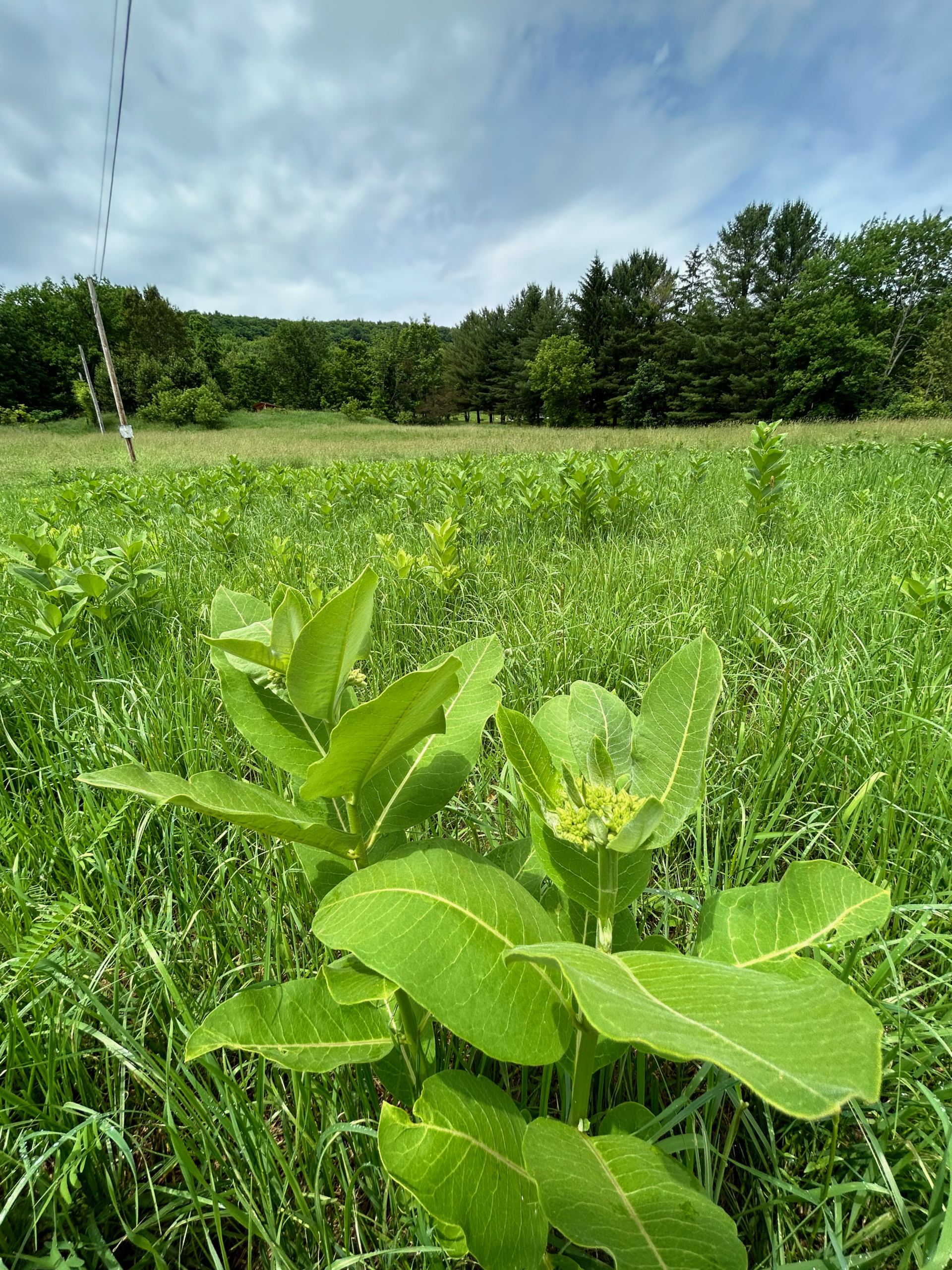
Home to various species of native wildflowers, the lower fields flanking the entrance to the Scowen Park trails constitute an incredibly valuable habitat for a variety of wildlife. The abundance of milkweed in these fields is of particular interest as this humble plant is critical to the Monarch Butterfly lifecycle. And so in our first meeting, we began by learning how to recognize milkweed.

This is a focal point of the project since it is the only plant a Monarch caterpillar will feed on making it essential for Monarch reproduction. Though there are several species of milkweed, the only species present at Scowen is Common Milkweed (Asclepias syriaca). After taking inventory of what Common Milkweed looks, feels, and smells like, we proceeded to mark a handful of data collection sites throughout the fields.
At our next meeting, we learned more about the Monarch life cycle and how to go about collecting data. Because Monarch caterpillars feed exclusively on milkweed, adult butterflies lay their eggs on this plant. There is typically one egg per plant and most often the egg can be found on the underside of the velvety leaves. Roughly the size of a pinhead, these eggs can be hard to detect and are easily confused with other things such as globs of congeled milkweed sap. Needless to say, collecting data required keen observation and a significant amount of patience!

Despite the abundance of milkweed at Scowen, we were surprised and slightly disappointed to find no eggs and no caterpillars (larvae) in several weeks of scouring the plants at our study sites. We wondered why that was. Had we simply overlooked the eggs because they were so tiny? Was something predating the eggs and caterpillars? Was there something else at work making this breeding ground less favourable than we had hoped? Though we were perplexed, we reminded ourselves that recording the absence of Monarchs was important data nonetheless. And so we carried on completing our Observation Forms (courtesy of Espace pour la vie’s Mission Monarch), data we would later upload to their database.

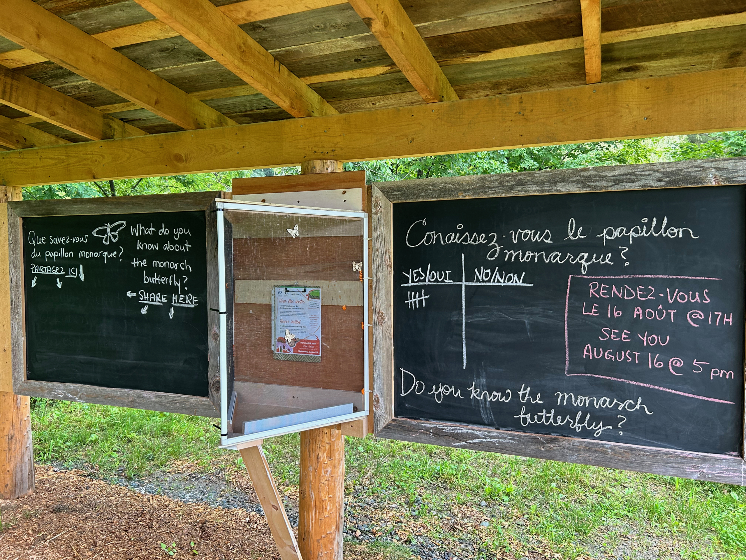
In August, we turned our attention to the installation of a nursery under the shelter at the park. Made entirely out of recycled materials, this screen structure was installed early in the month with the intention of having at least one caterpillar move in. Due to the fact we did not come across any monarch caterpillars at Scowen, we decided to “import” a caterpillar from the Brome Lake area. We highlighted this event as “Monarch Moving Day” and invited the public to attend to celebrate with us as we set our special guest up in his very own nursery, fresh milkweed sprigs and all.

We had members of the BB visiting the nursery every day thereafter to keep tabs on how things were going. Once moved in, the caterpillar kept busy feeding on milkweed while leaving impressively large quantities of frass on the nursery floor. A couple of days later, he had inched his way up to the roof of the nursery and just a day after that, was suspended from the roof, ready to pupate. By Sunday, August 20, we officially had a chrysalis!

The pupa stage “lasts eight to fifteen days under normal summer conditions” (monarchjointventure.org). You may recall the cool spell we experienced later in August and our little friend certainly seemed to have noticed as well! He stayed cozy in his chrysalis until a total of 18 days later when he emerged as a healthy adult butterfly (at this point, we were able to confirm he was a male based on the dark spots on his hind wings). He was released, free to forage on the nectar from a variety of wildflowers, all in preparation for his long journey south to Mexico.


The Role of the Nursery

When discussing the various components of the project, the following (and very valid) question was raised: What is the point of a nursery?

Human intervention can be a contentious topic when it comes to conservation efforts. How can we be certain we are doing more good than harm? Are we preventing nature from “taking its course”? These questions can be debated at length and conclusions are typically drawn on a case-by-case basis.
Simply put, the main goal of the Scowen Park nursery was to share the wonder. By creating a location where at least one Monarch could complete metamorphosis undisturbed, we were able to showcase the fascinating intricacies of this living being’s lifecycle. We were able to display and honour a small piece of the natural magic happening all around us.

Whether folks were closely following the project or only catching glimpses here and there, “wow moments” were had. This may seem trivial, but these “wow moments” are powerful. They are the foundation for gradually developing a sense of concern for the species with whom we coexist. Naturally, this sense of concern can have an impact on shaping our values and attitudes towards the natural world, trickling down into our everyday habits. While it is not a direct, linear path, it is a very natural one and is based on the premise that we tend to protect what we love… and we can only love what we know.

Taking in the pleasant smell of a milkweed flower for the first time, learning about the relationship between milkweed and Monarch caterpillars, catching glimpses of other neat invertebrate life on milkweed plants, watching a caterpillar pupate in real time, seeing a chrysalis for the first time, discovering you’ve been confusing Viceroy Butterflies (Limenitis archippus) for Monarch Butterflies this whole time… This project provided countless opportunities for learning, for wonder and for creating a closer connection with the natural world.

On a final note, we would like to recognize the immense value of the information and resources made available (for free) by Mission Monarch (Espace pour la vie), Monarch Joint Venture and the Butterflyway Project (David Suzuki Foundation). The overall project also relied heavily on the contributions of our super team of “Butterfly Brigade” volunteers who devoted hours to data collection and nursery surveillance, among other things. We are so grateful for every aspect of this year’s first Monarch Butterfly Project and eagerly anticipate its continuation in 2024!


Build Your Nature Vocabulary

Use the text and search the web to build your nature vocabulary and try using it the next time you’re out and about in nature, either making observations by yourself or with friends!

  • Endangered
  • Umbrella Species
  • Larvae
  • Frass
  • Pupate


References


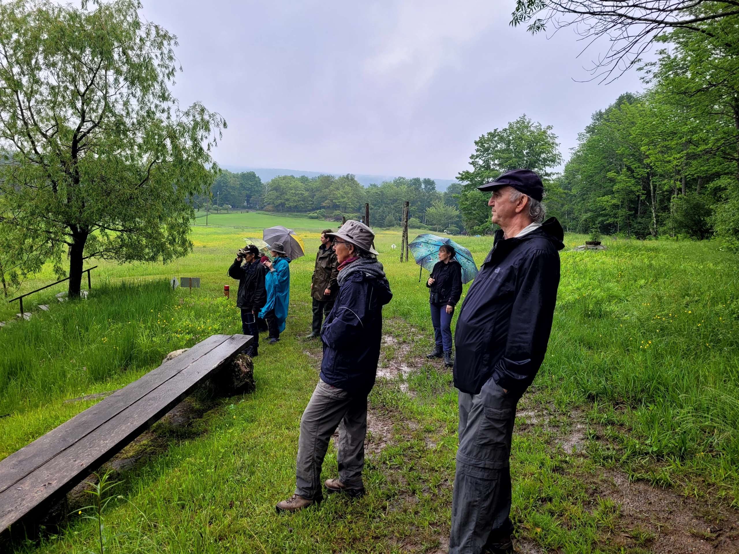
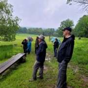
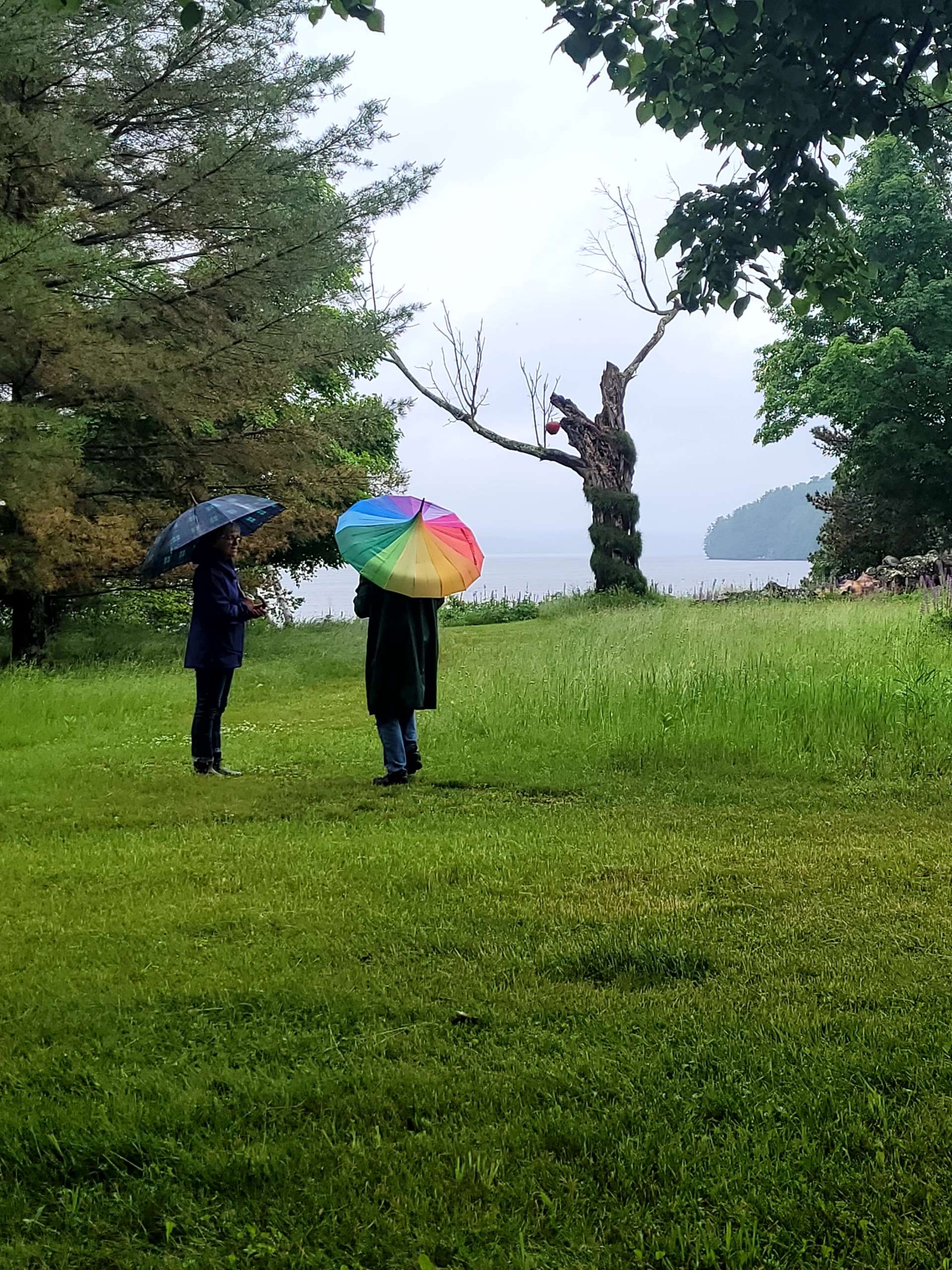
My birding Walk and Talk at Glen Villa, in the pouring rain on Saturday June 17th

Was it worth it? YES! 

With a pair of binoculars and some patience I observed and learned that you need to:

1) listen to its song

2) observe the flight patterns

3) study the habitat

4) look at the size and colour of the bird, shape of the tail, shape and colour of the beak and any other distinguishing marks to identify the bird.

As a participant, I was amazed at how quickly the guides (Camille and Jean-Paul, both members of SLOE and veteran bird watchers) identified birds in flight. They could spot the Blue Bird and the Swallow who often share the same size bird house and might even fight over who gets the box to build their nest.

Jean-Paul and Camille both have life lists which they share on E-Bird. Jean-Paul said he had several lists, one for Quebec, one for North America, others for different countries.

This information is available to scientists who track birds and study their patterns.

Camille wrote to us after the visit and said:

We saw, among others, a ruffed grouse and its young, a yellow-throated vireo (very rare) and three American Woodcocks (hard to see usually).

In all, 25 different species observed in the rain and dripping leaves.

If you want to know more about birding, I would encourage you to join La SLOE or the St. Francis Naturalist Club, These are two wonderful groups in our area, to help you find out more about birds and go on other great guided tours next year.

The activity at Glen Villa was organized in the context of the fundraiser for the Massawippi Foundation.

More guided Walks & Talks will be held on July 15th and August 12th, 2023 

Click here for more details.

Written by Nicolas Bousquet, Biol.
Field Project Coordinator
COGESAF
Cogesaf

Reading time: 5-6 minutes

The Lake Massawippi watershed is home to several species of salamander, particularly the stream  salamander. There are three species of stream salamander: the two-lined salamander, the northern dusky salamander and the purple salamander. The presence of numerous streams in forested and mountainous areas favours the presence of these species around Lake Massawippi.

Stream salamanders are very discreet but fascinating little creatures! These amphibians live mainly in small, cool, well-oxygenated streams. Surprisingly, this group of salamanders has no lungs, and breathes through its skin and larvae using gills. For this reason, stream salamanders must constantly keep their skin moist and live mainly in the aquatic environment. Although adults may venture a few meters from the stream into the terrestrial environment, they are usually found buried deep in the stream under rocks or other shelter such as branches. As for the larvae (juvenile salamanders), they are totally dependent on the aquatic environment, due to their gills.
deneme bonusu veren siteler
Because of their dependence on the aquatic environment, stream salamanders are very fragile species. In fact, the Northern Dusky Salamander is likely to be designated as threatened or vulnerable, and the Purple Salamander is designated as vulnerable under Quebec’s Act respecting threatened and vulnerable species. There are many conservation issues for stream salamanders, and generally speaking, they can be greatly affected by changes in the quantity and quality of the water in their habitat. Changes in the flow of a watercourse, deforestation of the riparian strip, sedimentation, contaminant inputs and the draining or drying up of watercourses are all factors that can considerably harm stream salamanders.

It’s interesting to note that some of the Massawippi Conservation Trust properties have been included in an extensive long-term monitoring program for stream salamanders. There are currently two studies underway. Indeed, as these properties are free of anthropogenic threats, it is interesting to see the evolution of populations in this sector over a 10-year period. This data can then be compared with sites undergoing significant pressure, such as those under forest management. In addition, the project aims to understand the potential impact of climate change on stream salamander populations. It is possible that climate change will have an impact on stream salamanders, particularly with increasingly frequent and intense dry spells in summer.
 

This long-term monitoring project stems from a problem often observed in the acquisition of rigorous data for population monitoring, particularly for species with precarious status. Indeed, the lack of funding for knowledge acquisition often results in significant gaps in our knowledge of population trends. The project sponsor, the Nature Conservancy of Canada, has therefore set up a long-term (10-year) monitoring program for the purple salamander throughout the Estrie region. Some ten conservation organizations are involved in the project, including COGESAF. Each organization is responsible for monitoring a small number of streams, thereby reducing project costs and workloads. COGESAF’s role in this project is to monitor two streams on sites designated as “no or low impact” by human activities on the properties of the Massawippi Conservation Trust. As a herpetology enthusiast who has been working as a biologist for COGESAF for the past 5 years, this project is particularly close to my heart. Finally, I’d like to highlight the collaboration of more than a dozen conservation organizations working together to improve knowledge of the purple salamander and protect it more effectively… in the hope that this project will inspire other initiatives like it for other species or other regions!
 

About the author: Nicolas Bousquet is a biologist and has been field project coordinator at COGESAF for over 5 years. His fields of expertise are invasive alien species control and biodiversity conservation. He worked as a research professional at the Université de Sherbrooke, before pursuing his career with an environmental and forest management consulting firm, then as an external consultant with the Ministère des Forêts, de la Faune et des Parcs. For several years, he has specialized in the study and conservation of herpetofauna, mainly turtles and stream salamanders. He has participated in a number of projects involving inventories, population monitoring, identification of threats, monitoring of egg-laying sites and the creation of facilities. He also enjoys sharing his knowledge, notably through lectures and writing articles.